You are here: Home > Network List > UW - Pacific Northwest Regional Seismic Network Stations List
> Station IRON Crane, OR, USA > Earthquake Result Viewer
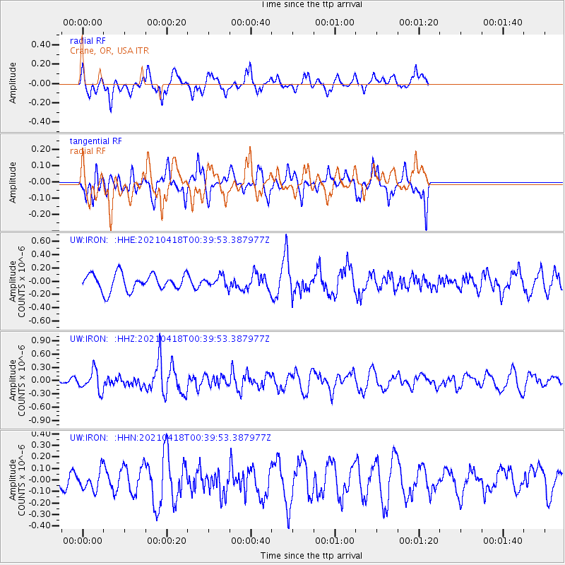
IRON Crane, OR, USA - Earthquake Result Viewer
*The percent match for this event was below the threshold and hence no stack was calculated.
| Earthquake location: |
Near East Coast Of Honshu, Japan |
| Earthquake latitude/longitude: |
38.4/141.9 |
| Earthquake time(UTC): |
2021/04/18 (108) 00:29:12 GMT |
| Earthquake Depth: |
52 km |
| Earthquake Magnitude: |
5.6 mww |
| Earthquake Catalog/Contributor: |
NEIC PDE/us |
|
| Network: |
UW Pacific Northwest Regional Seismic Network |
| Station: |
IRON Crane, OR, USA |
| Lat/Lon: |
43.36 N/118.47 W |
| Elevation: |
1226 m |
|
| Distance: |
70.9 deg |
| Az: |
49.548 deg |
| Baz: |
304.895 deg |
| Ray Param: |
$rayparam |
*The percent match for this event was below the threshold and hence was not used in the summary stack. |
|
| Radial Match: |
58.34749 % |
| Radial Bump: |
400 |
| Transverse Match: |
49.9389 % |
| Transverse Bump: |
400 |
| SOD ConfigId: |
24334971 |
| Insert Time: |
2021-05-02 00:55:12.554 +0000 |
| GWidth: |
2.5 |
| Max Bumps: |
400 |
| Tol: |
0.001 |
|
Signal To Noise
| Channel | StoN | STA | LTA |
| UW:IRON: :HHZ:20210418T00:39:53.387977Z | 2.4222145 | 2.3521068E-7 | 9.7105634E-8 |
| UW:IRON: :HHN:20210418T00:39:53.387977Z | 0.85741425 | 8.6225214E-8 | 1.0056425E-7 |
| UW:IRON: :HHE:20210418T00:39:53.387977Z | 0.63956004 | 8.0652654E-8 | 1.2610646E-7 |
| Arrivals |
| Ps | |
| PpPs | |
| PsPs/PpSs | |


