You are here: Home > Network List > AV - Alaska Volcano Observatory Stations List
> Station SPCR Ckakachatna River, Mount Spurr, Alaska > Earthquake Result Viewer
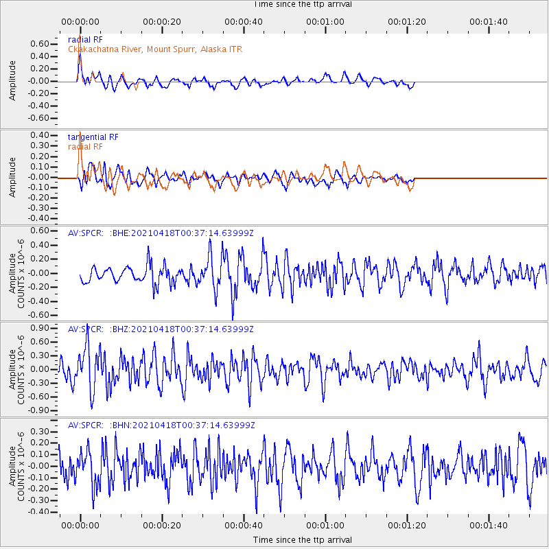
SPCR Ckakachatna River, Mount Spurr, Alaska - Earthquake Result Viewer
*The percent match for this event was below the threshold and hence no stack was calculated.
| Earthquake location: |
Near East Coast Of Honshu, Japan |
| Earthquake latitude/longitude: |
38.3/141.8 |
| Earthquake time(UTC): |
2021/04/18 (108) 00:29:25 GMT |
| Earthquake Depth: |
31 km |
| Earthquake Magnitude: |
5.6 mb |
| Earthquake Catalog/Contributor: |
NEIC PDE/us |
|
| Network: |
AV Alaska Volcano Observatory |
| Station: |
SPCR Ckakachatna River, Mount Spurr, Alaska |
| Lat/Lon: |
61.20 N/152.21 W |
| Elevation: |
984 m |
|
| Distance: |
46.0 deg |
| Az: |
37.953 deg |
| Baz: |
271.442 deg |
| Ray Param: |
$rayparam |
*The percent match for this event was below the threshold and hence was not used in the summary stack. |
|
| Radial Match: |
79.231186 % |
| Radial Bump: |
400 |
| Transverse Match: |
66.75746 % |
| Transverse Bump: |
400 |
| SOD ConfigId: |
24334971 |
| Insert Time: |
2021-05-02 01:02:51.276 +0000 |
| GWidth: |
2.5 |
| Max Bumps: |
400 |
| Tol: |
0.001 |
|
Signal To Noise
| Channel | StoN | STA | LTA |
| AV:SPCR: :BHZ:20210418T00:37:14.63999Z | 2.4181068 | 4.883285E-7 | 2.0194665E-7 |
| AV:SPCR: :BHN:20210418T00:37:14.63999Z | 1.6001347 | 1.4915143E-7 | 9.3211796E-8 |
| AV:SPCR: :BHE:20210418T00:37:14.63999Z | 2.055964 | 2.342588E-7 | 1.139411E-7 |
| Arrivals |
| Ps | |
| PpPs | |
| PsPs/PpSs | |


