You are here: Home > Network List > CI - Caltech Regional Seismic Network Stations List
> Station MPM Manuel Prospect Mine, California, USA > Earthquake Result Viewer
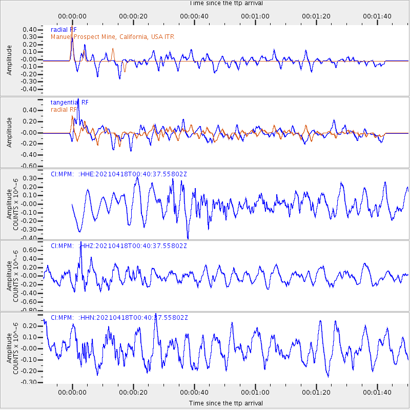
MPM Manuel Prospect Mine, California, USA - Earthquake Result Viewer
*The percent match for this event was below the threshold and hence no stack was calculated.
| Earthquake location: |
Near East Coast Of Honshu, Japan |
| Earthquake latitude/longitude: |
38.3/141.8 |
| Earthquake time(UTC): |
2021/04/18 (108) 00:29:25 GMT |
| Earthquake Depth: |
31 km |
| Earthquake Magnitude: |
5.6 mb |
| Earthquake Catalog/Contributor: |
NEIC PDE/us |
|
| Network: |
CI Caltech Regional Seismic Network |
| Station: |
MPM Manuel Prospect Mine, California, USA |
| Lat/Lon: |
36.06 N/117.49 W |
| Elevation: |
185 m |
|
| Distance: |
75.9 deg |
| Az: |
55.179 deg |
| Baz: |
307.113 deg |
| Ray Param: |
$rayparam |
*The percent match for this event was below the threshold and hence was not used in the summary stack. |
|
| Radial Match: |
50.69068 % |
| Radial Bump: |
400 |
| Transverse Match: |
58.498722 % |
| Transverse Bump: |
400 |
| SOD ConfigId: |
24334971 |
| Insert Time: |
2021-05-02 01:06:12.886 +0000 |
| GWidth: |
2.5 |
| Max Bumps: |
400 |
| Tol: |
0.001 |
|
Signal To Noise
| Channel | StoN | STA | LTA |
| CI:MPM: :HHZ:20210418T00:40:37.55802Z | 2.6221607 | 2.7932262E-7 | 1.0652384E-7 |
| CI:MPM: :HHN:20210418T00:40:37.55802Z | 0.82232267 | 1.1980892E-7 | 1.4569575E-7 |
| CI:MPM: :HHE:20210418T00:40:37.55802Z | 0.9349749 | 1.4074011E-7 | 1.5052822E-7 |
| Arrivals |
| Ps | |
| PpPs | |
| PsPs/PpSs | |


