You are here: Home > Network List > IW - Intermountain West Stations List
> Station MOOW Moose Ponds, Wyoming, USA > Earthquake Result Viewer
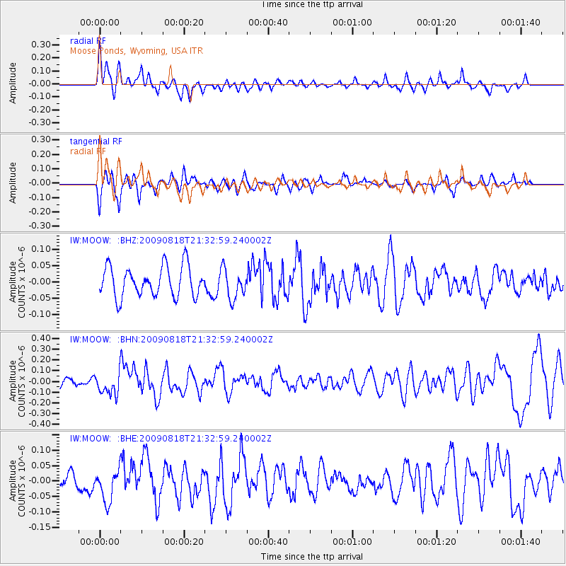
MOOW Moose Ponds, Wyoming, USA - Earthquake Result Viewer
*The percent match for this event was below the threshold and hence no stack was calculated.
| Earthquake location: |
South Of Fiji Islands |
| Earthquake latitude/longitude: |
-26.1/-178.4 |
| Earthquake time(UTC): |
2009/08/18 (230) 21:20:47 GMT |
| Earthquake Depth: |
270 km |
| Earthquake Magnitude: |
5.5 MB, 6.3 MW, 6.3 MW |
| Earthquake Catalog/Contributor: |
WHDF/NEIC |
|
| Network: |
IW Intermountain West |
| Station: |
MOOW Moose Ponds, Wyoming, USA |
| Lat/Lon: |
43.75 N/110.74 W |
| Elevation: |
2128 m |
|
| Distance: |
93.1 deg |
| Az: |
42.159 deg |
| Baz: |
236.413 deg |
| Ray Param: |
$rayparam |
*The percent match for this event was below the threshold and hence was not used in the summary stack. |
|
| Radial Match: |
63.647068 % |
| Radial Bump: |
400 |
| Transverse Match: |
67.29966 % |
| Transverse Bump: |
400 |
| SOD ConfigId: |
2622 |
| Insert Time: |
2010-03-09 07:23:58.571 +0000 |
| GWidth: |
2.5 |
| Max Bumps: |
400 |
| Tol: |
0.001 |
|
Signal To Noise
| Channel | StoN | STA | LTA |
| IW:MOOW: :BHN:20090818T21:32:59.240002Z | 2.2163966 | 1.0373036E-7 | 4.680135E-8 |
| IW:MOOW: :BHE:20090818T21:32:59.240002Z | 1.8969582 | 5.4569025E-8 | 2.8766593E-8 |
| IW:MOOW: :BHZ:20090818T21:32:59.240002Z | 0.9988715 | 4.6036366E-8 | 4.6088374E-8 |
| Arrivals |
| Ps | |
| PpPs | |
| PsPs/PpSs | |


