You are here: Home > Network List > TA - USArray Transportable Network (new EarthScope stations) Stations List
> Station G16K Koyuk River, AK, USA > Earthquake Result Viewer
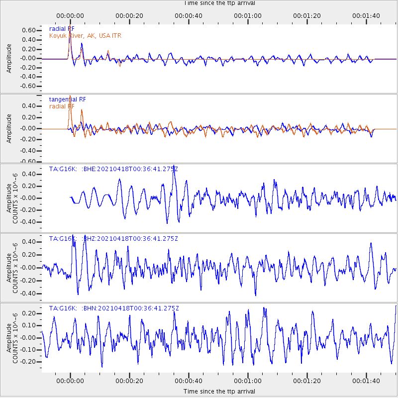
G16K Koyuk River, AK, USA - Earthquake Result Viewer
*The percent match for this event was below the threshold and hence no stack was calculated.
| Earthquake location: |
Near East Coast Of Honshu, Japan |
| Earthquake latitude/longitude: |
38.3/141.8 |
| Earthquake time(UTC): |
2021/04/18 (108) 00:29:25 GMT |
| Earthquake Depth: |
31 km |
| Earthquake Magnitude: |
5.6 mb |
| Earthquake Catalog/Contributor: |
NEIC PDE/us |
|
| Network: |
TA USArray Transportable Network (new EarthScope stations) |
| Station: |
G16K Koyuk River, AK, USA |
| Lat/Lon: |
65.39 N/162.35 W |
| Elevation: |
169 m |
|
| Distance: |
41.8 deg |
| Az: |
31.298 deg |
| Baz: |
257.578 deg |
| Ray Param: |
$rayparam |
*The percent match for this event was below the threshold and hence was not used in the summary stack. |
|
| Radial Match: |
75.09798 % |
| Radial Bump: |
400 |
| Transverse Match: |
44.94758 % |
| Transverse Bump: |
400 |
| SOD ConfigId: |
24334971 |
| Insert Time: |
2021-05-02 01:18:54.580 +0000 |
| GWidth: |
2.5 |
| Max Bumps: |
400 |
| Tol: |
0.001 |
|
Signal To Noise
| Channel | StoN | STA | LTA |
| TA:G16K: :BHZ:20210418T00:36:41.275Z | 1.9697242 | 2.7087017E-7 | 1.375168E-7 |
| TA:G16K: :BHN:20210418T00:36:41.275Z | 0.9953643 | 7.4954364E-8 | 7.530345E-8 |
| TA:G16K: :BHE:20210418T00:36:41.275Z | 1.4715523 | 1.9507668E-7 | 1.3256523E-7 |
| Arrivals |
| Ps | |
| PpPs | |
| PsPs/PpSs | |


