You are here: Home > Network List > IW - Intermountain West Stations List
> Station MOOW Moose Ponds, Wyoming, USA > Earthquake Result Viewer
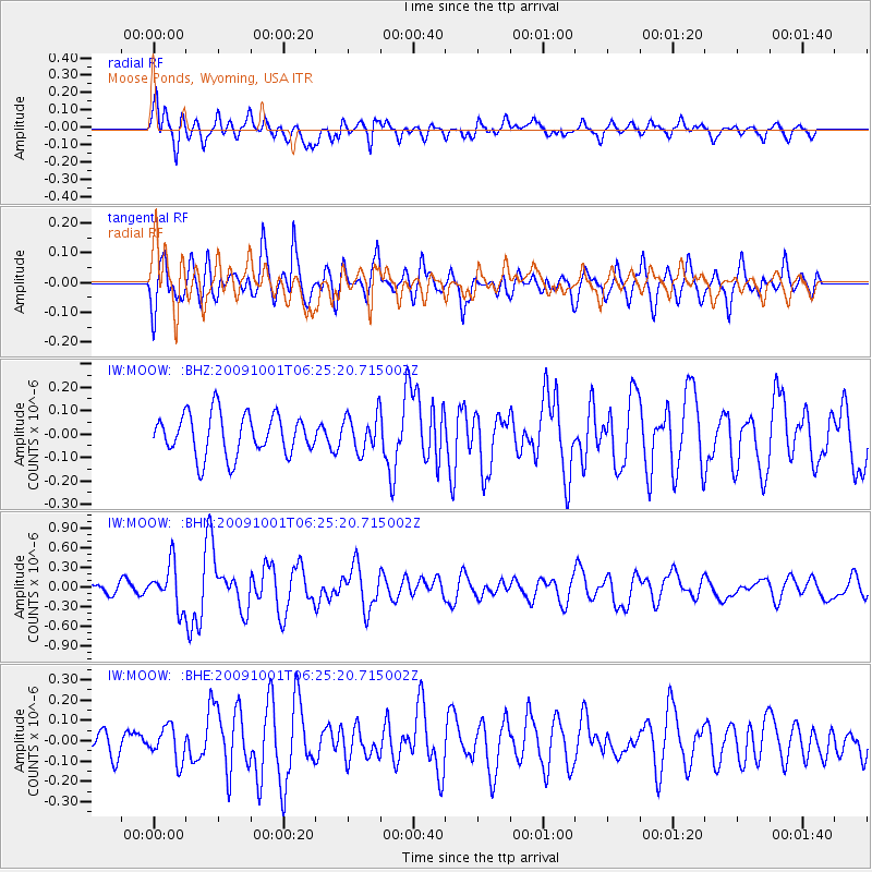
MOOW Moose Ponds, Wyoming, USA - Earthquake Result Viewer
*The percent match for this event was below the threshold and hence no stack was calculated.
| Earthquake location: |
Tonga Islands |
| Earthquake latitude/longitude: |
-15.4/-173.3 |
| Earthquake time(UTC): |
2009/10/01 (274) 06:13:32 GMT |
| Earthquake Depth: |
10 km |
| Earthquake Magnitude: |
5.6 MB, 5.7 MS, 5.8 MW, 5.7 MW |
| Earthquake Catalog/Contributor: |
WHDF/NEIC |
|
| Network: |
IW Intermountain West |
| Station: |
MOOW Moose Ponds, Wyoming, USA |
| Lat/Lon: |
43.75 N/110.74 W |
| Elevation: |
2128 m |
|
| Distance: |
81.9 deg |
| Az: |
40.492 deg |
| Baz: |
239.804 deg |
| Ray Param: |
$rayparam |
*The percent match for this event was below the threshold and hence was not used in the summary stack. |
|
| Radial Match: |
79.318825 % |
| Radial Bump: |
400 |
| Transverse Match: |
65.222855 % |
| Transverse Bump: |
400 |
| SOD ConfigId: |
2622 |
| Insert Time: |
2010-03-09 07:24:04.457 +0000 |
| GWidth: |
2.5 |
| Max Bumps: |
400 |
| Tol: |
0.001 |
|
Signal To Noise
| Channel | StoN | STA | LTA |
| IW:MOOW: :BHN:20091001T06:25:20.715002Z | 4.3156962 | 3.2392404E-7 | 7.5057194E-8 |
| IW:MOOW: :BHE:20091001T06:25:20.715002Z | 0.7694 | 8.299112E-8 | 1.0786473E-7 |
| IW:MOOW: :BHZ:20091001T06:25:20.715002Z | 0.87526965 | 7.71232E-8 | 8.8113644E-8 |
| Arrivals |
| Ps | |
| PpPs | |
| PsPs/PpSs | |


