You are here: Home > Network List > IW - Intermountain West Stations List
> Station MOOW Moose Ponds, Wyoming, USA > Earthquake Result Viewer
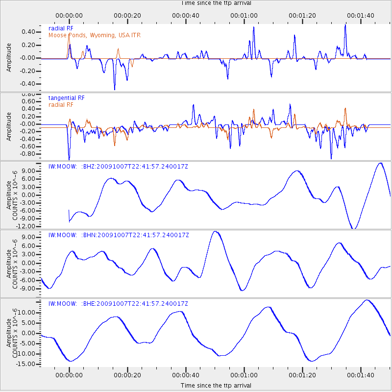
MOOW Moose Ponds, Wyoming, USA - Earthquake Result Viewer
*The percent match for this event was below the threshold and hence no stack was calculated.
| Earthquake location: |
Santa Cruz Islands |
| Earthquake latitude/longitude: |
-11.5/166.0 |
| Earthquake time(UTC): |
2009/10/07 (280) 22:29:18 GMT |
| Earthquake Depth: |
35 km |
| Earthquake Magnitude: |
5.5 MB |
| Earthquake Catalog/Contributor: |
WHDF/NEIC |
|
| Network: |
IW Intermountain West |
| Station: |
MOOW Moose Ponds, Wyoming, USA |
| Lat/Lon: |
43.75 N/110.74 W |
| Elevation: |
2128 m |
|
| Distance: |
93.0 deg |
| Az: |
46.107 deg |
| Baz: |
257.078 deg |
| Ray Param: |
$rayparam |
*The percent match for this event was below the threshold and hence was not used in the summary stack. |
|
| Radial Match: |
77.249626 % |
| Radial Bump: |
285 |
| Transverse Match: |
82.3187 % |
| Transverse Bump: |
400 |
| SOD ConfigId: |
2622 |
| Insert Time: |
2010-03-09 07:24:06.382 +0000 |
| GWidth: |
2.5 |
| Max Bumps: |
400 |
| Tol: |
0.001 |
|
Signal To Noise
| Channel | StoN | STA | LTA |
| IW:MOOW: :BHN:20091007T22:41:57.240017Z | 0.79911697 | 3.557538E-6 | 4.4518365E-6 |
| IW:MOOW: :BHE:20091007T22:41:57.240017Z | 2.8747025 | 1.4961108E-5 | 5.2044024E-6 |
| IW:MOOW: :BHZ:20091007T22:41:57.240017Z | 0.5528179 | 3.1064474E-6 | 5.6192957E-6 |
| Arrivals |
| Ps | |
| PpPs | |
| PsPs/PpSs | |


