You are here: Home > Network List > IW - Intermountain West Stations List
> Station MOOW Moose Ponds, Wyoming, USA > Earthquake Result Viewer
MOOW Moose Ponds, Wyoming, USA - Earthquake Result Viewer
*The percent match for this event was below the threshold and hence no stack was calculated.
| Earthquake location: |
Santa Cruz Islands |
| Earthquake latitude/longitude: |
-11.4/166.4 |
| Earthquake time(UTC): |
2009/10/31 (304) 19:09:51 GMT |
| Earthquake Depth: |
134 km |
| Earthquake Magnitude: |
5.9 MB, 5.9 MW, 5.9 MW |
| Earthquake Catalog/Contributor: |
WHDF/NEIC |
|
| Network: |
IW Intermountain West |
| Station: |
MOOW Moose Ponds, Wyoming, USA |
| Lat/Lon: |
43.75 N/110.74 W |
| Elevation: |
2128 m |
|
| Distance: |
92.7 deg |
| Az: |
46.046 deg |
| Baz: |
256.936 deg |
| Ray Param: |
$rayparam |
*The percent match for this event was below the threshold and hence was not used in the summary stack. |
|
| Radial Match: |
60.044777 % |
| Radial Bump: |
400 |
| Transverse Match: |
61.57181 % |
| Transverse Bump: |
400 |
| SOD ConfigId: |
2622 |
| Insert Time: |
2010-03-09 07:24:10.050 +0000 |
| GWidth: |
2.5 |
| Max Bumps: |
400 |
| Tol: |
0.001 |
|
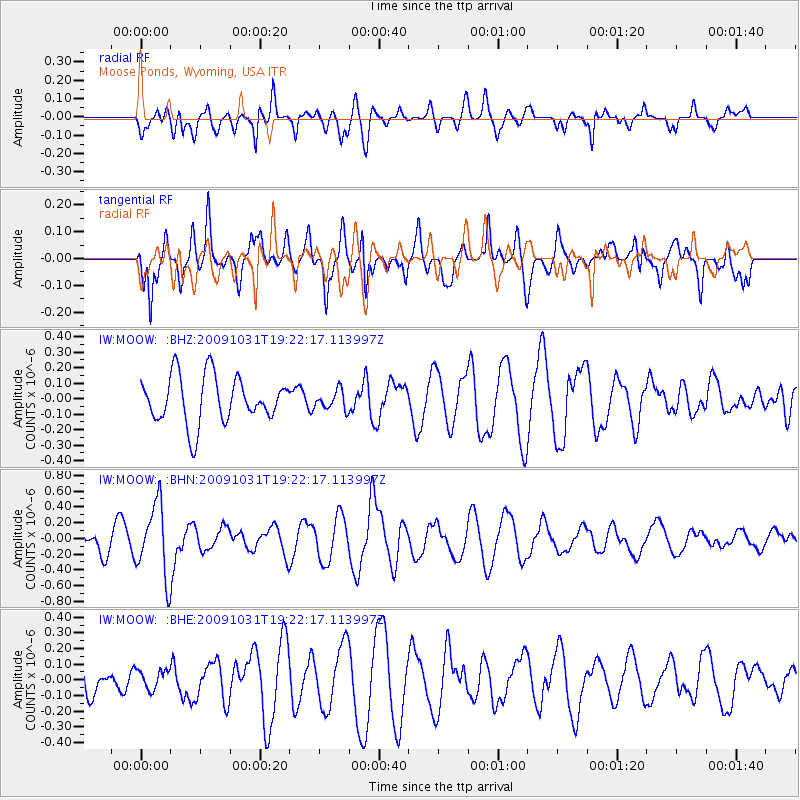
Signal To Noise
| Channel | StoN | STA | LTA |
| IW:MOOW: :BHN:20091031T19:22:17.113997Z | 3.5872476 | 4.5661994E-7 | 1.2728978E-7 |
| IW:MOOW: :BHE:20091031T19:22:17.113997Z | 0.5553279 | 6.193969E-8 | 1.1153713E-7 |
| IW:MOOW: :BHZ:20091031T19:22:17.113997Z | 0.40743583 | 6.143465E-8 | 1.5078362E-7 |
| Arrivals |
| Ps | |
| PpPs | |
| PsPs/PpSs | |


