You are here: Home > Network List > IW - Intermountain West Stations List
> Station MOOW Moose Ponds, Wyoming, USA > Earthquake Result Viewer
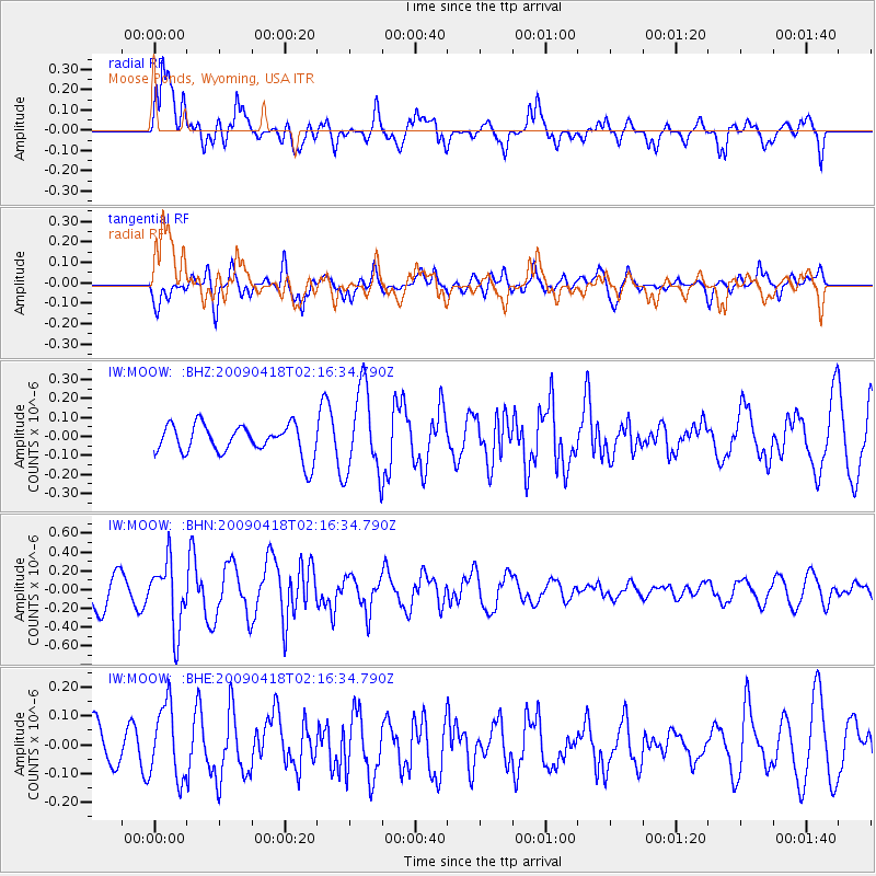
MOOW Moose Ponds, Wyoming, USA - Earthquake Result Viewer
*The percent match for this event was below the threshold and hence no stack was calculated.
| Earthquake location: |
Kermadec Islands Region |
| Earthquake latitude/longitude: |
-28.9/-177.4 |
| Earthquake time(UTC): |
2009/04/18 (108) 02:03:52 GMT |
| Earthquake Depth: |
65 km |
| Earthquake Magnitude: |
6.0 MB, 5.8 MW, 5.7 MW |
| Earthquake Catalog/Contributor: |
WHDF/NEIC |
|
| Network: |
IW Intermountain West |
| Station: |
MOOW Moose Ponds, Wyoming, USA |
| Lat/Lon: |
43.75 N/110.74 W |
| Elevation: |
2128 m |
|
| Distance: |
94.6 deg |
| Az: |
41.893 deg |
| Baz: |
233.882 deg |
| Ray Param: |
$rayparam |
*The percent match for this event was below the threshold and hence was not used in the summary stack. |
|
| Radial Match: |
67.73599 % |
| Radial Bump: |
400 |
| Transverse Match: |
65.926765 % |
| Transverse Bump: |
400 |
| SOD ConfigId: |
2658 |
| Insert Time: |
2010-03-09 07:24:16.127 +0000 |
| GWidth: |
2.5 |
| Max Bumps: |
400 |
| Tol: |
0.001 |
|
Signal To Noise
| Channel | StoN | STA | LTA |
| IW:MOOW: :BHN:20090418T02:16:34.790Z | 1.9159652 | 3.5441658E-7 | 1.8498069E-7 |
| IW:MOOW: :BHE:20090418T02:16:34.790Z | 1.3093662 | 1.2774389E-7 | 9.756162E-8 |
| IW:MOOW: :BHZ:20090418T02:16:34.790Z | 2.842342 | 2.2557602E-7 | 7.9362735E-8 |
| Arrivals |
| Ps | |
| PpPs | |
| PsPs/PpSs | |


