You are here: Home > Network List > WI - West Indies IPGP Network Stations List
> Station MAGL Barre de l'ile, Marie-Galante, Guadeloupe > Earthquake Result Viewer
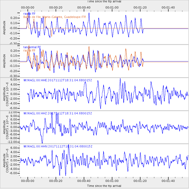
MAGL Barre de l'ile, Marie-Galante, Guadeloupe - Earthquake Result Viewer
*The percent match for this event was below the threshold and hence no stack was calculated.
| Earthquake location: |
Iran-Iraq Border Region |
| Earthquake latitude/longitude: |
34.9/46.0 |
| Earthquake time(UTC): |
2017/11/12 (316) 18:18:17 GMT |
| Earthquake Depth: |
19 km |
| Earthquake Magnitude: |
7.3 Mww |
| Earthquake Catalog/Contributor: |
NEIC PDE/us |
|
| Network: |
WI West Indies IPGP Network |
| Station: |
MAGL Barre de l'ile, Marie-Galante, Guadeloupe |
| Lat/Lon: |
15.95 N/61.28 W |
| Elevation: |
159 m |
|
| Distance: |
94.5 deg |
| Az: |
292.833 deg |
| Baz: |
51.945 deg |
| Ray Param: |
$rayparam |
*The percent match for this event was below the threshold and hence was not used in the summary stack. |
|
| Radial Match: |
75.44703 % |
| Radial Bump: |
400 |
| Transverse Match: |
67.9374 % |
| Transverse Bump: |
400 |
| SOD ConfigId: |
2429771 |
| Insert Time: |
2017-11-26 18:23:29.071 +0000 |
| GWidth: |
2.5 |
| Max Bumps: |
400 |
| Tol: |
0.001 |
|
Signal To Noise
| Channel | StoN | STA | LTA |
| WI:MAGL:00:HHZ:20171112T18:31:04.680015Z | 3.1408372 | 3.081183E-6 | 9.810069E-7 |
| WI:MAGL:00:HHN:20171112T18:31:04.680015Z | 1.1779474 | 1.245055E-6 | 1.0569701E-6 |
| WI:MAGL:00:HHE:20171112T18:31:04.680015Z | 1.2003139 | 1.5038023E-6 | 1.2528409E-6 |
| Arrivals |
| Ps | |
| PpPs | |
| PsPs/PpSs | |


