You are here: Home > Network List > IW - Intermountain West Stations List
> Station MOOW Moose Ponds, Wyoming, USA > Earthquake Result Viewer
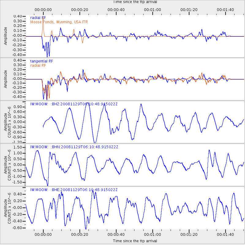
MOOW Moose Ponds, Wyoming, USA - Earthquake Result Viewer
*The percent match for this event was below the threshold and hence no stack was calculated.
| Earthquake location: |
Fiji Islands Region |
| Earthquake latitude/longitude: |
-18.7/-177.7 |
| Earthquake time(UTC): |
2008/11/29 (334) 05:59:16 GMT |
| Earthquake Depth: |
386 km |
| Earthquake Magnitude: |
5.7 MB, 6.0 MW, 5.9 MW |
| Earthquake Catalog/Contributor: |
WHDF/NEIC |
|
| Network: |
IW Intermountain West |
| Station: |
MOOW Moose Ponds, Wyoming, USA |
| Lat/Lon: |
43.75 N/110.74 W |
| Elevation: |
2128 m |
|
| Distance: |
87.2 deg |
| Az: |
41.894 deg |
| Baz: |
240.853 deg |
| Ray Param: |
$rayparam |
*The percent match for this event was below the threshold and hence was not used in the summary stack. |
|
| Radial Match: |
78.567726 % |
| Radial Bump: |
400 |
| Transverse Match: |
88.514175 % |
| Transverse Bump: |
400 |
| SOD ConfigId: |
2658 |
| Insert Time: |
2010-03-09 07:24:20.146 +0000 |
| GWidth: |
2.5 |
| Max Bumps: |
400 |
| Tol: |
0.001 |
|
Signal To Noise
| Channel | StoN | STA | LTA |
| IW:MOOW: :BHN:20081129T06:10:48.915022Z | 2.8545003 | 1.0207863E-6 | 3.5760593E-7 |
| IW:MOOW: :BHE:20081129T06:10:48.915022Z | 1.1274037 | 2.2305808E-7 | 1.9785111E-7 |
| IW:MOOW: :BHZ:20081129T06:10:48.915022Z | 1.3102373 | 7.2193797E-7 | 5.5099787E-7 |
| Arrivals |
| Ps | |
| PpPs | |
| PsPs/PpSs | |


