You are here: Home > Network List > IW - Intermountain West Stations List
> Station MOOW Moose Ponds, Wyoming, USA > Earthquake Result Viewer
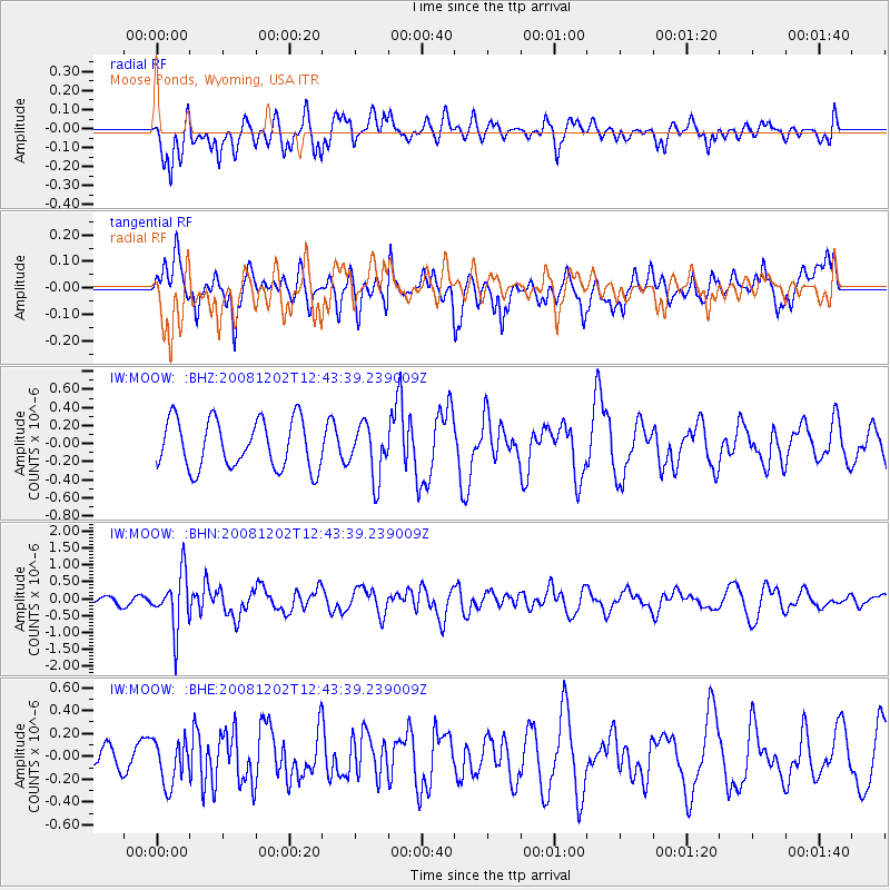
MOOW Moose Ponds, Wyoming, USA - Earthquake Result Viewer
*The percent match for this event was below the threshold and hence no stack was calculated.
| Earthquake location: |
Mariana Islands |
| Earthquake latitude/longitude: |
19.1/145.8 |
| Earthquake time(UTC): |
2008/12/02 (337) 12:31:43 GMT |
| Earthquake Depth: |
137 km |
| Earthquake Magnitude: |
5.9 MB, 5.9 MW, 5.9 MW |
| Earthquake Catalog/Contributor: |
WHDF/NEIC |
|
| Network: |
IW Intermountain West |
| Station: |
MOOW Moose Ponds, Wyoming, USA |
| Lat/Lon: |
43.75 N/110.74 W |
| Elevation: |
2128 m |
|
| Distance: |
86.3 deg |
| Az: |
44.92 deg |
| Baz: |
292.878 deg |
| Ray Param: |
$rayparam |
*The percent match for this event was below the threshold and hence was not used in the summary stack. |
|
| Radial Match: |
55.426052 % |
| Radial Bump: |
400 |
| Transverse Match: |
60.465767 % |
| Transverse Bump: |
400 |
| SOD ConfigId: |
2658 |
| Insert Time: |
2010-03-09 07:24:21.131 +0000 |
| GWidth: |
2.5 |
| Max Bumps: |
400 |
| Tol: |
0.001 |
|
Signal To Noise
| Channel | StoN | STA | LTA |
| IW:MOOW: :BHN:20081202T12:43:39.239009Z | 4.181622 | 8.086106E-7 | 1.9337249E-7 |
| IW:MOOW: :BHE:20081202T12:43:39.239009Z | 1.2133303 | 1.9535433E-7 | 1.6100672E-7 |
| IW:MOOW: :BHZ:20081202T12:43:39.239009Z | 1.089731 | 2.9228667E-7 | 2.682191E-7 |
| Arrivals |
| Ps | |
| PpPs | |
| PsPs/PpSs | |


