You are here: Home > Network List > US - United States National Seismic Network Stations List
> Station EGMT Eagleton, Montana, USA > Earthquake Result Viewer
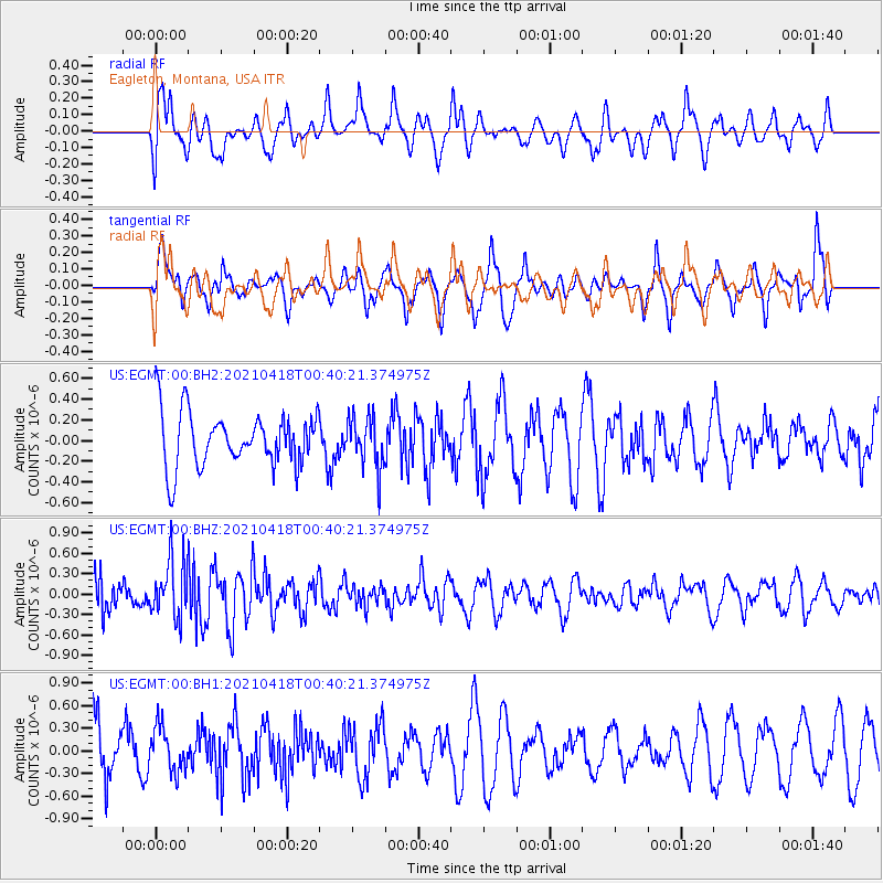
EGMT Eagleton, Montana, USA - Earthquake Result Viewer
*The percent match for this event was below the threshold and hence no stack was calculated.
| Earthquake location: |
Near East Coast Of Honshu, Japan |
| Earthquake latitude/longitude: |
38.3/141.8 |
| Earthquake time(UTC): |
2021/04/18 (108) 00:29:25 GMT |
| Earthquake Depth: |
31 km |
| Earthquake Magnitude: |
5.6 mb |
| Earthquake Catalog/Contributor: |
NEIC PDE/us |
|
| Network: |
US United States National Seismic Network |
| Station: |
EGMT Eagleton, Montana, USA |
| Lat/Lon: |
48.02 N/109.75 W |
| Elevation: |
1055 m |
|
| Distance: |
73.1 deg |
| Az: |
41.729 deg |
| Baz: |
308.7 deg |
| Ray Param: |
$rayparam |
*The percent match for this event was below the threshold and hence was not used in the summary stack. |
|
| Radial Match: |
63.73089 % |
| Radial Bump: |
400 |
| Transverse Match: |
65.39351 % |
| Transverse Bump: |
400 |
| SOD ConfigId: |
24334971 |
| Insert Time: |
2021-05-02 01:21:50.593 +0000 |
| GWidth: |
2.5 |
| Max Bumps: |
400 |
| Tol: |
0.001 |
|
Signal To Noise
| Channel | StoN | STA | LTA |
| US:EGMT:00:BHZ:20210418T00:40:21.374975Z | 1.4999921 | 4.1916852E-7 | 2.7944714E-7 |
| US:EGMT:00:BH1:20210418T00:40:21.374975Z | 1.0219109 | 2.950486E-7 | 2.8872245E-7 |
| US:EGMT:00:BH2:20210418T00:40:21.374975Z | 0.93681383 | 2.43698E-7 | 2.6013493E-7 |
| Arrivals |
| Ps | |
| PpPs | |
| PsPs/PpSs | |


