You are here: Home > Network List > US - United States National Seismic Network Stations List
> Station MIAR Mount Ida, Arkansas, USA > Earthquake Result Viewer
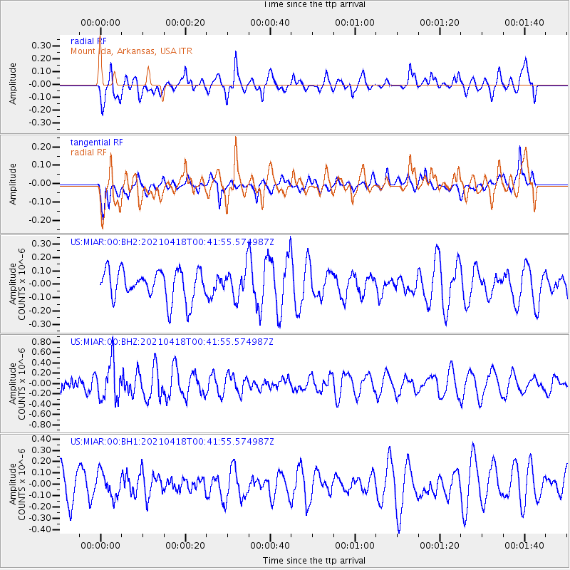
MIAR Mount Ida, Arkansas, USA - Earthquake Result Viewer
*The percent match for this event was below the threshold and hence no stack was calculated.
| Earthquake location: |
Near East Coast Of Honshu, Japan |
| Earthquake latitude/longitude: |
38.3/141.8 |
| Earthquake time(UTC): |
2021/04/18 (108) 00:29:25 GMT |
| Earthquake Depth: |
31 km |
| Earthquake Magnitude: |
5.6 mb |
| Earthquake Catalog/Contributor: |
NEIC PDE/us |
|
| Network: |
US United States National Seismic Network |
| Station: |
MIAR Mount Ida, Arkansas, USA |
| Lat/Lon: |
34.55 N/93.58 W |
| Elevation: |
207 m |
|
| Distance: |
91.2 deg |
| Az: |
42.82 deg |
| Baz: |
319.599 deg |
| Ray Param: |
$rayparam |
*The percent match for this event was below the threshold and hence was not used in the summary stack. |
|
| Radial Match: |
70.656425 % |
| Radial Bump: |
400 |
| Transverse Match: |
52.024635 % |
| Transverse Bump: |
400 |
| SOD ConfigId: |
24334971 |
| Insert Time: |
2021-05-02 01:22:04.316 +0000 |
| GWidth: |
2.5 |
| Max Bumps: |
400 |
| Tol: |
0.001 |
|
Signal To Noise
| Channel | StoN | STA | LTA |
| US:MIAR:00:BHZ:20210418T00:41:55.574987Z | 1.8686649 | 3.630051E-7 | 1.9425909E-7 |
| US:MIAR:00:BH1:20210418T00:41:55.574987Z | 0.80913395 | 1.0877621E-7 | 1.3443537E-7 |
| US:MIAR:00:BH2:20210418T00:41:55.574987Z | 0.97943974 | 1.0940378E-7 | 1.11700366E-7 |
| Arrivals |
| Ps | |
| PpPs | |
| PsPs/PpSs | |


