You are here: Home > Network List > US - United States National Seismic Network Stations List
> Station MNTX Cornudas Mountains, Texas, USA > Earthquake Result Viewer
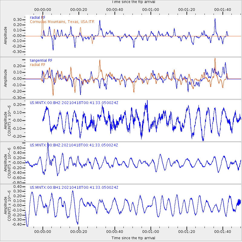
MNTX Cornudas Mountains, Texas, USA - Earthquake Result Viewer
*The percent match for this event was below the threshold and hence no stack was calculated.
| Earthquake location: |
Near East Coast Of Honshu, Japan |
| Earthquake latitude/longitude: |
38.3/141.8 |
| Earthquake time(UTC): |
2021/04/18 (108) 00:29:25 GMT |
| Earthquake Depth: |
31 km |
| Earthquake Magnitude: |
5.6 mb |
| Earthquake Catalog/Contributor: |
NEIC PDE/us |
|
| Network: |
US United States National Seismic Network |
| Station: |
MNTX Cornudas Mountains, Texas, USA |
| Lat/Lon: |
31.70 N/105.38 W |
| Elevation: |
404 m |
|
| Distance: |
86.4 deg |
| Az: |
51.947 deg |
| Baz: |
313.354 deg |
| Ray Param: |
$rayparam |
*The percent match for this event was below the threshold and hence was not used in the summary stack. |
|
| Radial Match: |
59.147045 % |
| Radial Bump: |
391 |
| Transverse Match: |
57.191658 % |
| Transverse Bump: |
400 |
| SOD ConfigId: |
24334971 |
| Insert Time: |
2021-05-02 01:22:04.874 +0000 |
| GWidth: |
2.5 |
| Max Bumps: |
400 |
| Tol: |
0.001 |
|
Signal To Noise
| Channel | StoN | STA | LTA |
| US:MNTX:00:BHZ:20210418T00:41:33.050024Z | 2.6405542 | 3.287742E-7 | 1.2450954E-7 |
| US:MNTX:00:BH1:20210418T00:41:33.050024Z | 0.57288057 | 1.0535547E-7 | 1.8390476E-7 |
| US:MNTX:00:BH2:20210418T00:41:33.050024Z | 1.0080007 | 9.5364015E-8 | 9.4607095E-8 |
| Arrivals |
| Ps | |
| PpPs | |
| PsPs/PpSs | |


