You are here: Home > Network List > IW - Intermountain West Stations List
> Station MOOW Moose Ponds, Wyoming, USA > Earthquake Result Viewer
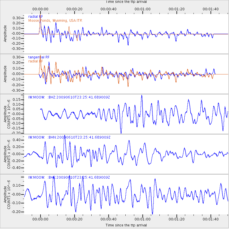
MOOW Moose Ponds, Wyoming, USA - Earthquake Result Viewer
*The percent match for this event was below the threshold and hence no stack was calculated.
| Earthquake location: |
West Chile Rise |
| Earthquake latitude/longitude: |
-41.7/-84.0 |
| Earthquake time(UTC): |
2009/06/10 (161) 23:13:21 GMT |
| Earthquake Depth: |
10 km |
| Earthquake Magnitude: |
5.7 MB, 5.2 MS, 5.7 MW, 5.6 MW |
| Earthquake Catalog/Contributor: |
WHDF/NEIC |
|
| Network: |
IW Intermountain West |
| Station: |
MOOW Moose Ponds, Wyoming, USA |
| Lat/Lon: |
43.75 N/110.74 W |
| Elevation: |
2128 m |
|
| Distance: |
88.4 deg |
| Az: |
340.955 deg |
| Baz: |
160.3 deg |
| Ray Param: |
$rayparam |
*The percent match for this event was below the threshold and hence was not used in the summary stack. |
|
| Radial Match: |
73.00964 % |
| Radial Bump: |
400 |
| Transverse Match: |
76.910416 % |
| Transverse Bump: |
400 |
| SOD ConfigId: |
2648 |
| Insert Time: |
2010-03-09 07:24:23.665 +0000 |
| GWidth: |
2.5 |
| Max Bumps: |
400 |
| Tol: |
0.001 |
|
Signal To Noise
| Channel | StoN | STA | LTA |
| IW:MOOW: :BHN:20090610T23:25:41.689009Z | 3.8580248 | 1.6886752E-7 | 4.3770456E-8 |
| IW:MOOW: :BHE:20090610T23:25:41.689009Z | 2.3470137 | 8.655952E-8 | 3.68807E-8 |
| IW:MOOW: :BHZ:20090610T23:25:41.689009Z | 0.89513165 | 2.6757004E-8 | 2.9891694E-8 |
| Arrivals |
| Ps | |
| PpPs | |
| PsPs/PpSs | |


