You are here: Home > Network List > US - United States National Seismic Network Stations List
> Station OGNE Ogallala, Nebraska, USA > Earthquake Result Viewer
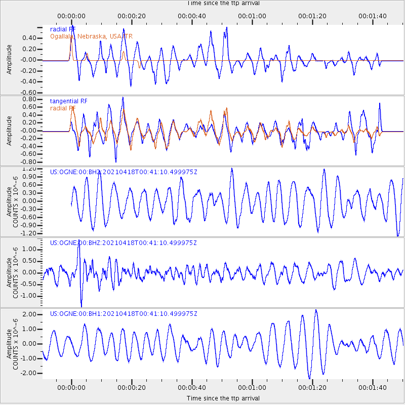
OGNE Ogallala, Nebraska, USA - Earthquake Result Viewer
*The percent match for this event was below the threshold and hence no stack was calculated.
| Earthquake location: |
Near East Coast Of Honshu, Japan |
| Earthquake latitude/longitude: |
38.3/141.8 |
| Earthquake time(UTC): |
2021/04/18 (108) 00:29:25 GMT |
| Earthquake Depth: |
31 km |
| Earthquake Magnitude: |
5.6 mb |
| Earthquake Catalog/Contributor: |
NEIC PDE/us |
|
| Network: |
US United States National Seismic Network |
| Station: |
OGNE Ogallala, Nebraska, USA |
| Lat/Lon: |
40.95 N/102.03 W |
| Elevation: |
1054 m |
|
| Distance: |
81.9 deg |
| Az: |
43.381 deg |
| Baz: |
314.464 deg |
| Ray Param: |
$rayparam |
*The percent match for this event was below the threshold and hence was not used in the summary stack. |
|
| Radial Match: |
47.006958 % |
| Radial Bump: |
339 |
| Transverse Match: |
64.67401 % |
| Transverse Bump: |
341 |
| SOD ConfigId: |
24334971 |
| Insert Time: |
2021-05-02 01:22:12.507 +0000 |
| GWidth: |
2.5 |
| Max Bumps: |
400 |
| Tol: |
0.001 |
|
Signal To Noise
| Channel | StoN | STA | LTA |
| US:OGNE:00:BHZ:20210418T00:41:10.499975Z | 3.1390848 | 6.741736E-7 | 2.1476755E-7 |
| US:OGNE:00:BH1:20210418T00:41:10.499975Z | 0.84042627 | 6.9328115E-7 | 8.2491607E-7 |
| US:OGNE:00:BH2:20210418T00:41:10.499975Z | 0.78964907 | 4.260318E-7 | 5.395204E-7 |
| Arrivals |
| Ps | |
| PpPs | |
| PsPs/PpSs | |


