You are here: Home > Network List > UU - University of Utah Regional Network Stations List
> Station FORU South Mineral Mountains, UT, USA > Earthquake Result Viewer
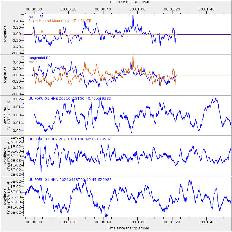
FORU South Mineral Mountains, UT, USA - Earthquake Result Viewer
*The percent match for this event was below the threshold and hence no stack was calculated.
| Earthquake location: |
Near East Coast Of Honshu, Japan |
| Earthquake latitude/longitude: |
38.3/141.8 |
| Earthquake time(UTC): |
2021/04/18 (108) 00:29:25 GMT |
| Earthquake Depth: |
31 km |
| Earthquake Magnitude: |
5.6 mb |
| Earthquake Catalog/Contributor: |
NEIC PDE/us |
|
| Network: |
UU University of Utah Regional Network |
| Station: |
FORU South Mineral Mountains, UT, USA |
| Lat/Lon: |
38.46 N/112.86 W |
| Elevation: |
1840 m |
|
| Distance: |
77.4 deg |
| Az: |
50.903 deg |
| Baz: |
308.915 deg |
| Ray Param: |
$rayparam |
*The percent match for this event was below the threshold and hence was not used in the summary stack. |
|
| Radial Match: |
50.903397 % |
| Radial Bump: |
400 |
| Transverse Match: |
47.99756 % |
| Transverse Bump: |
400 |
| SOD ConfigId: |
24334971 |
| Insert Time: |
2021-05-02 01:22:37.632 +0000 |
| GWidth: |
2.5 |
| Max Bumps: |
400 |
| Tol: |
0.001 |
|
Signal To Noise
| Channel | StoN | STA | LTA |
| UU:FORU:01:HHZ:20210418T00:40:45.62998Z | 1.9688313 | 9.5032195E-9 | 4.8268327E-9 |
| UU:FORU:01:HHN:20210418T00:40:45.62998Z | 1.6510783 | 8.089734E-9 | 4.8996673E-9 |
| UU:FORU:01:HHE:20210418T00:40:45.62998Z | 0.91890645 | 9.992163E-9 | 1.0873971E-8 |
| Arrivals |
| Ps | |
| PpPs | |
| PsPs/PpSs | |


