You are here: Home > Network List > IW - Intermountain West Stations List
> Station MOOW Moose Ponds, Wyoming, USA > Earthquake Result Viewer
MOOW Moose Ponds, Wyoming, USA - Earthquake Result Viewer
*The percent match for this event was below the threshold and hence no stack was calculated.
| Earthquake location: |
Baffin Bay |
| Earthquake latitude/longitude: |
75.4/-72.5 |
| Earthquake time(UTC): |
2009/07/07 (188) 19:11:46 GMT |
| Earthquake Depth: |
19 km |
| Earthquake Magnitude: |
5.9 MB, 5.7 MS, 6.1 MW, 6.0 MW |
| Earthquake Catalog/Contributor: |
WHDF/NEIC |
|
| Network: |
IW Intermountain West |
| Station: |
MOOW Moose Ponds, Wyoming, USA |
| Lat/Lon: |
43.75 N/110.74 W |
| Elevation: |
2128 m |
|
| Distance: |
35.8 deg |
| Az: |
230.159 deg |
| Baz: |
15.643 deg |
| Ray Param: |
$rayparam |
*The percent match for this event was below the threshold and hence was not used in the summary stack. |
|
| Radial Match: |
75.71477 % |
| Radial Bump: |
397 |
| Transverse Match: |
75.56891 % |
| Transverse Bump: |
400 |
| SOD ConfigId: |
2648 |
| Insert Time: |
2010-03-09 07:24:34.303 +0000 |
| GWidth: |
2.5 |
| Max Bumps: |
400 |
| Tol: |
0.001 |
|
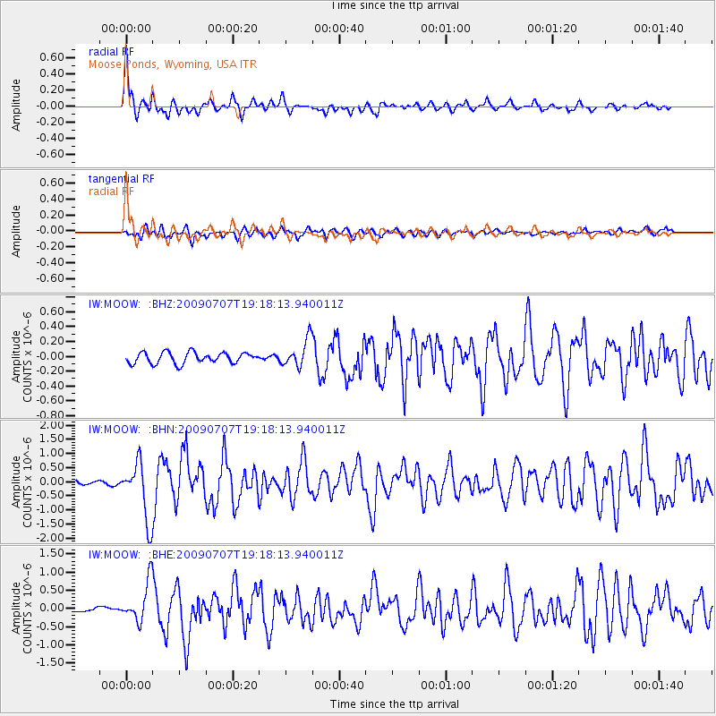
Signal To Noise
| Channel | StoN | STA | LTA |
| IW:MOOW: :BHN:20090707T19:18:13.940011Z | 17.721142 | 1.0305793E-6 | 5.8155354E-8 |
| IW:MOOW: :BHE:20090707T19:18:13.940011Z | 8.814483 | 5.502052E-7 | 6.242059E-8 |
| IW:MOOW: :BHZ:20090707T19:18:13.940011Z | 2.551117 | 1.8645412E-7 | 7.308724E-8 |
| Arrivals |
| Ps | |
| PpPs | |
| PsPs/PpSs | |


