You are here: Home > Network List > IW - Intermountain West Stations List
> Station MOOW Moose Ponds, Wyoming, USA > Earthquake Result Viewer
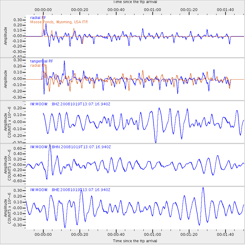
MOOW Moose Ponds, Wyoming, USA - Earthquake Result Viewer
*The percent match for this event was below the threshold and hence no stack was calculated.
| Earthquake location: |
Tonga Islands |
| Earthquake latitude/longitude: |
-22.0/-173.7 |
| Earthquake time(UTC): |
2008/10/19 (293) 12:55:05 GMT |
| Earthquake Depth: |
35 km |
| Earthquake Magnitude: |
5.7 MB, 5.3 MS, 5.6 MW, 5.5 MW |
| Earthquake Catalog/Contributor: |
WHDF/NEIC |
|
| Network: |
IW Intermountain West |
| Station: |
MOOW Moose Ponds, Wyoming, USA |
| Lat/Lon: |
43.75 N/110.74 W |
| Elevation: |
2128 m |
|
| Distance: |
87.2 deg |
| Az: |
40.259 deg |
| Baz: |
235.868 deg |
| Ray Param: |
$rayparam |
*The percent match for this event was below the threshold and hence was not used in the summary stack. |
|
| Radial Match: |
68.7015 % |
| Radial Bump: |
350 |
| Transverse Match: |
41.905487 % |
| Transverse Bump: |
400 |
| SOD ConfigId: |
2556 |
| Insert Time: |
2010-03-09 07:24:40.832 +0000 |
| GWidth: |
2.5 |
| Max Bumps: |
400 |
| Tol: |
0.001 |
|
Signal To Noise
| Channel | StoN | STA | LTA |
| IW:MOOW: :BHN:20081019T13:07:16.940Z | 4.8800874 | 3.7312307E-7 | 7.645828E-8 |
| IW:MOOW: :BHE:20081019T13:07:16.940Z | 1.4498166 | 1.3502087E-7 | 9.3129614E-8 |
| IW:MOOW: :BHZ:20081019T13:07:16.940Z | 0.6077532 | 5.166494E-8 | 8.500974E-8 |
| Arrivals |
| Ps | |
| PpPs | |
| PsPs/PpSs | |


