You are here: Home > Network List > IW - Intermountain West Stations List
> Station MOOW Moose Ponds, Wyoming, USA > Earthquake Result Viewer
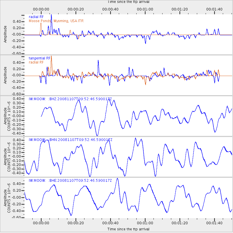
MOOW Moose Ponds, Wyoming, USA - Earthquake Result Viewer
*The percent match for this event was below the threshold and hence no stack was calculated.
| Earthquake location: |
Vanuatu Islands |
| Earthquake latitude/longitude: |
-14.9/168.1 |
| Earthquake time(UTC): |
2008/11/07 (312) 09:40:00 GMT |
| Earthquake Depth: |
10 km |
| Earthquake Magnitude: |
5.5 MB, 4.9 MS, 5.5 MW |
| Earthquake Catalog/Contributor: |
WHDF/NEIC |
|
| Network: |
IW Intermountain West |
| Station: |
MOOW Moose Ponds, Wyoming, USA |
| Lat/Lon: |
43.75 N/110.74 W |
| Elevation: |
2128 m |
|
| Distance: |
93.9 deg |
| Az: |
45.867 deg |
| Baz: |
253.214 deg |
| Ray Param: |
$rayparam |
*The percent match for this event was below the threshold and hence was not used in the summary stack. |
|
| Radial Match: |
81.15959 % |
| Radial Bump: |
400 |
| Transverse Match: |
85.66224 % |
| Transverse Bump: |
359 |
| SOD ConfigId: |
2658 |
| Insert Time: |
2010-03-09 07:24:44.816 +0000 |
| GWidth: |
2.5 |
| Max Bumps: |
400 |
| Tol: |
0.001 |
|
Signal To Noise
| Channel | StoN | STA | LTA |
| IW:MOOW: :BHN:20081107T09:52:46.590017Z | 1.5988905 | 3.8544147E-7 | 2.4106808E-7 |
| IW:MOOW: :BHE:20081107T09:52:46.590017Z | 0.8662879 | 1.772942E-7 | 2.0465967E-7 |
| IW:MOOW: :BHZ:20081107T09:52:46.590017Z | 1.613914 | 3.0636593E-7 | 1.8982792E-7 |
| Arrivals |
| Ps | |
| PpPs | |
| PsPs/PpSs | |


