You are here: Home > Network List > IW - Intermountain West Stations List
> Station MOOW Moose Ponds, Wyoming, USA > Earthquake Result Viewer
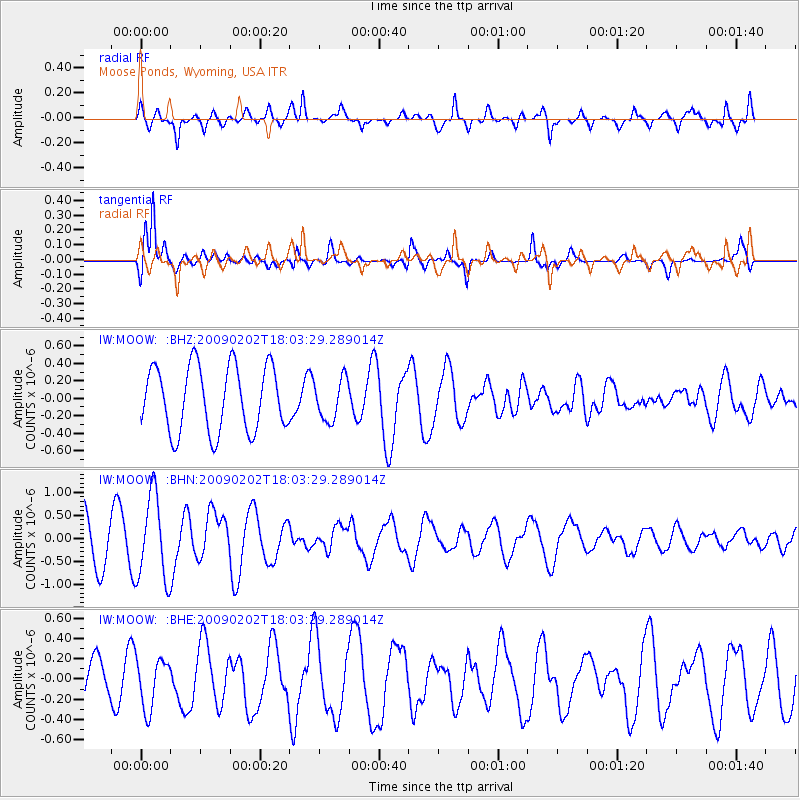
MOOW Moose Ponds, Wyoming, USA - Earthquake Result Viewer
*The percent match for this event was below the threshold and hence no stack was calculated.
| Earthquake location: |
Near Coast Of Peru |
| Earthquake latitude/longitude: |
-13.6/-76.6 |
| Earthquake time(UTC): |
2009/02/02 (033) 17:53:21 GMT |
| Earthquake Depth: |
21 km |
| Earthquake Magnitude: |
5.6 MB, 5.6 MS, 6.0 MW, 5.9 MW |
| Earthquake Catalog/Contributor: |
WHDF/NEIC |
|
| Network: |
IW Intermountain West |
| Station: |
MOOW Moose Ponds, Wyoming, USA |
| Lat/Lon: |
43.75 N/110.74 W |
| Elevation: |
2128 m |
|
| Distance: |
65.0 deg |
| Az: |
333.309 deg |
| Baz: |
142.936 deg |
| Ray Param: |
$rayparam |
*The percent match for this event was below the threshold and hence was not used in the summary stack. |
|
| Radial Match: |
65.95606 % |
| Radial Bump: |
400 |
| Transverse Match: |
73.938995 % |
| Transverse Bump: |
332 |
| SOD ConfigId: |
6627 |
| Insert Time: |
2010-03-09 07:24:45.623 +0000 |
| GWidth: |
2.5 |
| Max Bumps: |
400 |
| Tol: |
0.001 |
|
Signal To Noise
| Channel | StoN | STA | LTA |
| IW:MOOW: :BHN:20090202T18:03:29.289014Z | 1.8157688 | 9.2380924E-7 | 5.087703E-7 |
| IW:MOOW: :BHE:20090202T18:03:29.289014Z | 1.0006523 | 2.4572972E-7 | 2.4556954E-7 |
| IW:MOOW: :BHZ:20090202T18:03:29.289014Z | 0.63092077 | 2.3527552E-7 | 3.729082E-7 |
| Arrivals |
| Ps | |
| PpPs | |
| PsPs/PpSs | |


