You are here: Home > Network List > IW - Intermountain West Stations List
> Station MOOW Moose Ponds, Wyoming, USA > Earthquake Result Viewer
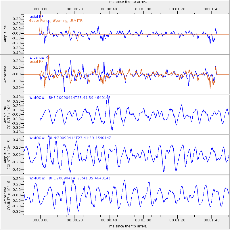
MOOW Moose Ponds, Wyoming, USA - Earthquake Result Viewer
*The percent match for this event was below the threshold and hence no stack was calculated.
| Earthquake location: |
Fiji Islands Region |
| Earthquake latitude/longitude: |
-16.3/-177.7 |
| Earthquake time(UTC): |
2009/04/14 (104) 23:29:33 GMT |
| Earthquake Depth: |
10 km |
| Earthquake Magnitude: |
5.5 MS, 5.4 MB, 5.9 MW, 5.9 MW |
| Earthquake Catalog/Contributor: |
WHDF/NEIC |
|
| Network: |
IW Intermountain West |
| Station: |
MOOW Moose Ponds, Wyoming, USA |
| Lat/Lon: |
43.75 N/110.74 W |
| Elevation: |
2128 m |
|
| Distance: |
85.4 deg |
| Az: |
42.002 deg |
| Baz: |
242.458 deg |
| Ray Param: |
$rayparam |
*The percent match for this event was below the threshold and hence was not used in the summary stack. |
|
| Radial Match: |
59.49967 % |
| Radial Bump: |
400 |
| Transverse Match: |
70.32638 % |
| Transverse Bump: |
383 |
| SOD ConfigId: |
2658 |
| Insert Time: |
2010-03-09 07:24:46.478 +0000 |
| GWidth: |
2.5 |
| Max Bumps: |
400 |
| Tol: |
0.001 |
|
Signal To Noise
| Channel | StoN | STA | LTA |
| IW:MOOW: :BHN:20090414T23:41:39.464014Z | 1.6919978 | 2.8144507E-7 | 1.6633892E-7 |
| IW:MOOW: :BHE:20090414T23:41:39.464014Z | 1.0394909 | 9.112263E-8 | 8.766082E-8 |
| IW:MOOW: :BHZ:20090414T23:41:39.464014Z | 1.2300272 | 1.2171633E-7 | 9.895418E-8 |
| Arrivals |
| Ps | |
| PpPs | |
| PsPs/PpSs | |


