You are here: Home > Network List > IW - Intermountain West Stations List
> Station MOOW Moose Ponds, Wyoming, USA > Earthquake Result Viewer
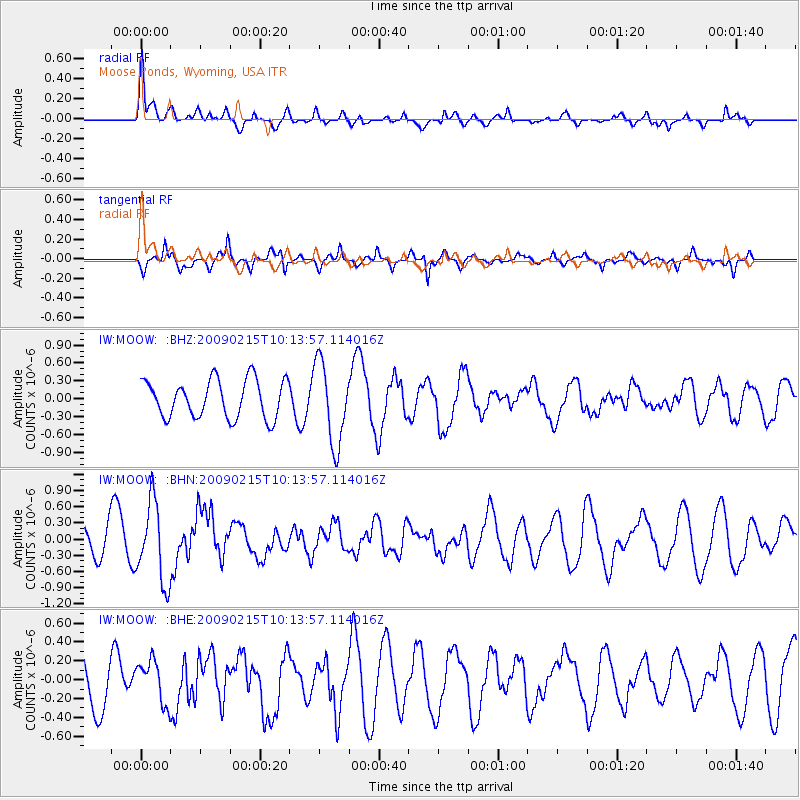
MOOW Moose Ponds, Wyoming, USA - Earthquake Result Viewer
*The percent match for this event was below the threshold and hence no stack was calculated.
| Earthquake location: |
Near Coast Of Northern Peru |
| Earthquake latitude/longitude: |
-5.9/-80.9 |
| Earthquake time(UTC): |
2009/02/15 (046) 10:04:49 GMT |
| Earthquake Depth: |
21 km |
| Earthquake Magnitude: |
5.8 MB, 5.7 MS, 6.1 MW, 6.1 MW |
| Earthquake Catalog/Contributor: |
WHDF/NEIC |
|
| Network: |
IW Intermountain West |
| Station: |
MOOW Moose Ponds, Wyoming, USA |
| Lat/Lon: |
43.75 N/110.74 W |
| Elevation: |
2128 m |
|
| Distance: |
56.3 deg |
| Az: |
334.289 deg |
| Baz: |
143.447 deg |
| Ray Param: |
$rayparam |
*The percent match for this event was below the threshold and hence was not used in the summary stack. |
|
| Radial Match: |
67.473305 % |
| Radial Bump: |
400 |
| Transverse Match: |
54.558796 % |
| Transverse Bump: |
292 |
| SOD ConfigId: |
2658 |
| Insert Time: |
2010-03-09 07:24:47.268 +0000 |
| GWidth: |
2.5 |
| Max Bumps: |
400 |
| Tol: |
0.001 |
|
Signal To Noise
| Channel | StoN | STA | LTA |
| IW:MOOW: :BHN:20090215T10:13:57.114016Z | 2.2889802 | 7.426737E-7 | 3.2445615E-7 |
| IW:MOOW: :BHE:20090215T10:13:57.114016Z | 0.92952526 | 2.2738782E-7 | 2.446279E-7 |
| IW:MOOW: :BHZ:20090215T10:13:57.114016Z | 2.1688395 | 6.881762E-7 | 3.173016E-7 |
| Arrivals |
| Ps | |
| PpPs | |
| PsPs/PpSs | |


