You are here: Home > Network List > IW - Intermountain West Stations List
> Station MOOW Moose Ponds, Wyoming, USA > Earthquake Result Viewer
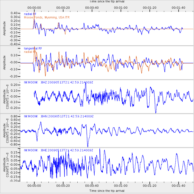
MOOW Moose Ponds, Wyoming, USA - Earthquake Result Viewer
*The percent match for this event was below the threshold and hence no stack was calculated.
| Earthquake location: |
Tonga Islands |
| Earthquake latitude/longitude: |
-15.8/-173.5 |
| Earthquake time(UTC): |
2009/05/13 (133) 21:31:17 GMT |
| Earthquake Depth: |
85 km |
| Earthquake Magnitude: |
5.8 MW, 5.3 MB, 5.8 MW |
| Earthquake Catalog/Contributor: |
WHDF/NEIC |
|
| Network: |
IW Intermountain West |
| Station: |
MOOW Moose Ponds, Wyoming, USA |
| Lat/Lon: |
43.75 N/110.74 W |
| Elevation: |
2128 m |
|
| Distance: |
82.3 deg |
| Az: |
40.547 deg |
| Baz: |
239.743 deg |
| Ray Param: |
$rayparam |
*The percent match for this event was below the threshold and hence was not used in the summary stack. |
|
| Radial Match: |
62.04644 % |
| Radial Bump: |
400 |
| Transverse Match: |
68.558815 % |
| Transverse Bump: |
400 |
| SOD ConfigId: |
2760 |
| Insert Time: |
2010-03-09 07:24:48.378 +0000 |
| GWidth: |
2.5 |
| Max Bumps: |
400 |
| Tol: |
0.001 |
|
Signal To Noise
| Channel | StoN | STA | LTA |
| IW:MOOW: :BHN:20090513T21:42:59.214009Z | 4.061234 | 2.648858E-7 | 6.522299E-8 |
| IW:MOOW: :BHE:20090513T21:42:59.214009Z | 1.0889037 | 6.0922986E-8 | 5.5948924E-8 |
| IW:MOOW: :BHZ:20090513T21:42:59.214009Z | 1.4941897 | 8.599173E-8 | 5.7550743E-8 |
| Arrivals |
| Ps | |
| PpPs | |
| PsPs/PpSs | |


