You are here: Home > Network List > IW - Intermountain West Stations List
> Station MOOW Moose Ponds, Wyoming, USA > Earthquake Result Viewer
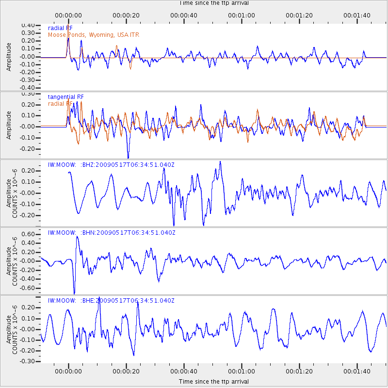
MOOW Moose Ponds, Wyoming, USA - Earthquake Result Viewer
*The percent match for this event was below the threshold and hence no stack was calculated.
| Earthquake location: |
Tonga Islands |
| Earthquake latitude/longitude: |
-16.8/-173.5 |
| Earthquake time(UTC): |
2009/05/17 (137) 06:23:03 GMT |
| Earthquake Depth: |
67 km |
| Earthquake Magnitude: |
5.5 MB, 5.6 MW, 5.6 MW |
| Earthquake Catalog/Contributor: |
WHDF/NEIC |
|
| Network: |
IW Intermountain West |
| Station: |
MOOW Moose Ponds, Wyoming, USA |
| Lat/Lon: |
43.75 N/110.74 W |
| Elevation: |
2128 m |
|
| Distance: |
83.1 deg |
| Az: |
40.459 deg |
| Baz: |
239.044 deg |
| Ray Param: |
$rayparam |
*The percent match for this event was below the threshold and hence was not used in the summary stack. |
|
| Radial Match: |
47.820457 % |
| Radial Bump: |
400 |
| Transverse Match: |
56.803318 % |
| Transverse Bump: |
400 |
| SOD ConfigId: |
2760 |
| Insert Time: |
2010-03-09 07:24:51.186 +0000 |
| GWidth: |
2.5 |
| Max Bumps: |
400 |
| Tol: |
0.001 |
|
Signal To Noise
| Channel | StoN | STA | LTA |
| IW:MOOW: :BHN:20090517T06:34:51.040Z | 2.901534 | 3.1810487E-7 | 1.0963334E-7 |
| IW:MOOW: :BHE:20090517T06:34:51.040Z | 1.0816957 | 1.216656E-7 | 1.12476734E-7 |
| IW:MOOW: :BHZ:20090517T06:34:51.040Z | 1.1427118 | 1.0496573E-7 | 9.185669E-8 |
| Arrivals |
| Ps | |
| PpPs | |
| PsPs/PpSs | |


