You are here: Home > Network List > TA - USArray Transportable Network (new EarthScope stations) Stations List
> Station G31M Satah River, YT, CAN > Earthquake Result Viewer
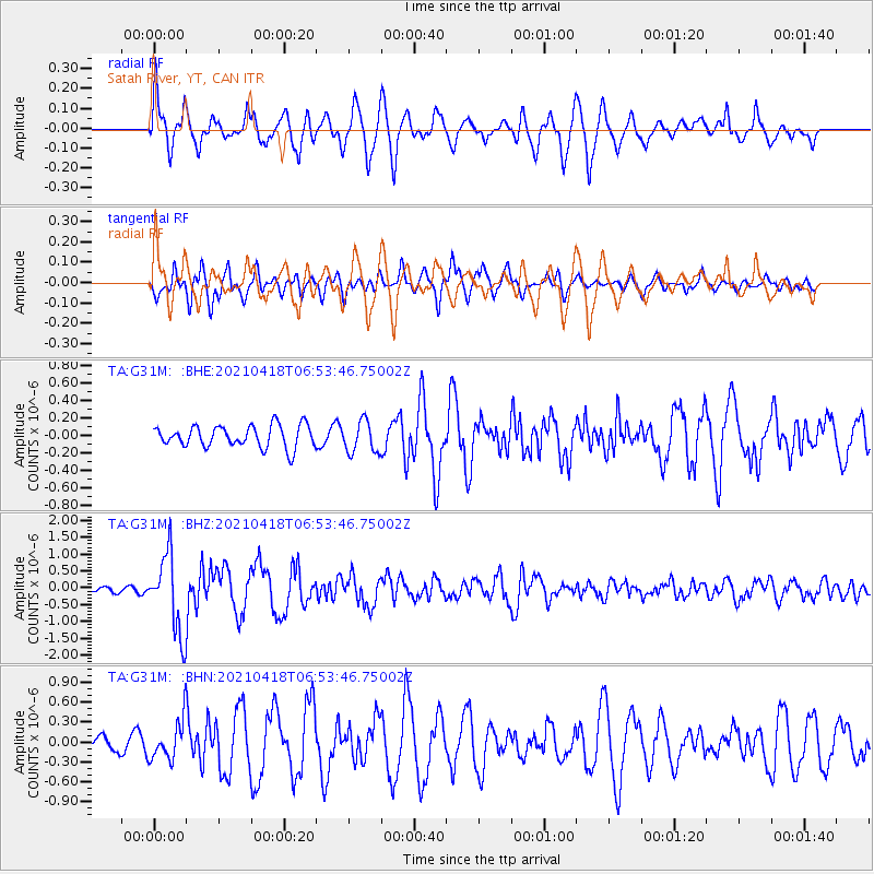
G31M Satah River, YT, CAN - Earthquake Result Viewer
*The percent match for this event was below the threshold and hence no stack was calculated.
| Earthquake location: |
Southern Iran |
| Earthquake latitude/longitude: |
29.8/50.7 |
| Earthquake time(UTC): |
2021/04/18 (108) 06:41:50 GMT |
| Earthquake Depth: |
10 km |
| Earthquake Magnitude: |
5.8 mww |
| Earthquake Catalog/Contributor: |
NEIC PDE/us |
|
| Network: |
TA USArray Transportable Network (new EarthScope stations) |
| Station: |
G31M Satah River, YT, CAN |
| Lat/Lon: |
66.92 N/134.27 W |
| Elevation: |
61 m |
|
| Distance: |
83.5 deg |
| Az: |
1.958 deg |
| Baz: |
355.679 deg |
| Ray Param: |
$rayparam |
*The percent match for this event was below the threshold and hence was not used in the summary stack. |
|
| Radial Match: |
69.104675 % |
| Radial Bump: |
400 |
| Transverse Match: |
73.7488 % |
| Transverse Bump: |
400 |
| SOD ConfigId: |
24334971 |
| Insert Time: |
2021-05-02 06:56:58.619 +0000 |
| GWidth: |
2.5 |
| Max Bumps: |
400 |
| Tol: |
0.001 |
|
Signal To Noise
| Channel | StoN | STA | LTA |
| TA:G31M: :BHZ:20210418T06:53:46.75002Z | 13.065456 | 1.1613606E-6 | 8.8887866E-8 |
| TA:G31M: :BHN:20210418T06:53:46.75002Z | 1.2524291 | 2.9408426E-7 | 2.348111E-7 |
| TA:G31M: :BHE:20210418T06:53:46.75002Z | 1.4521729 | 1.8067158E-7 | 1.2441464E-7 |
| Arrivals |
| Ps | |
| PpPs | |
| PsPs/PpSs | |


