You are here: Home > Network List > IW - Intermountain West Stations List
> Station MOOW Moose Ponds, Wyoming, USA > Earthquake Result Viewer
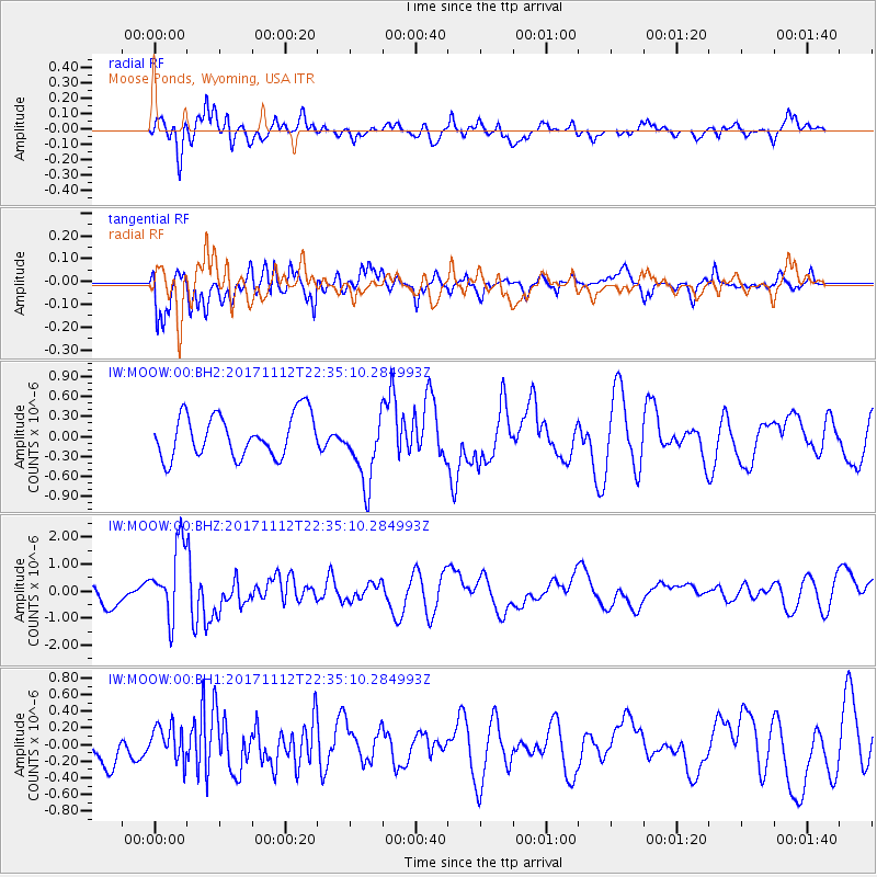
MOOW Moose Ponds, Wyoming, USA - Earthquake Result Viewer
*The percent match for this event was below the threshold and hence no stack was calculated.
| Earthquake location: |
Off East Coast Of Honshu, Japan |
| Earthquake latitude/longitude: |
38.1/144.9 |
| Earthquake time(UTC): |
2017/11/12 (316) 22:24:07 GMT |
| Earthquake Depth: |
9.5 km |
| Earthquake Magnitude: |
5.8 Mww |
| Earthquake Catalog/Contributor: |
NEIC PDE/us |
|
| Network: |
IW Intermountain West |
| Station: |
MOOW Moose Ponds, Wyoming, USA |
| Lat/Lon: |
43.75 N/110.74 W |
| Elevation: |
2128 m |
|
| Distance: |
73.7 deg |
| Az: |
47.014 deg |
| Baz: |
307.169 deg |
| Ray Param: |
$rayparam |
*The percent match for this event was below the threshold and hence was not used in the summary stack. |
|
| Radial Match: |
58.33673 % |
| Radial Bump: |
400 |
| Transverse Match: |
78.952255 % |
| Transverse Bump: |
400 |
| SOD ConfigId: |
2429771 |
| Insert Time: |
2017-11-26 22:27:11.487 +0000 |
| GWidth: |
2.5 |
| Max Bumps: |
400 |
| Tol: |
0.001 |
|
Signal To Noise
| Channel | StoN | STA | LTA |
| IW:MOOW:00:BHZ:20171112T22:35:10.284993Z | 3.1407084 | 1.3608767E-6 | 4.3330246E-7 |
| IW:MOOW:00:BH1:20171112T22:35:10.284993Z | 0.859888 | 2.1369087E-7 | 2.4851013E-7 |
| IW:MOOW:00:BH2:20171112T22:35:10.284993Z | 1.6379704 | 5.218194E-7 | 3.1857678E-7 |
| Arrivals |
| Ps | |
| PpPs | |
| PsPs/PpSs | |


