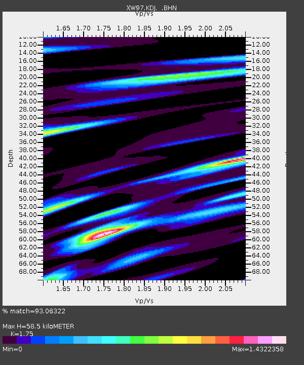
KDJ XW.KDJ - Earthquake Result Viewer
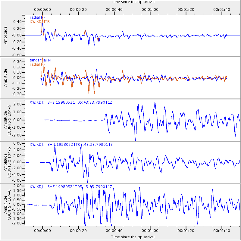
Earthquake location: Minahassa Peninsula, Sulawesi
Earthquake latitude/longitude: 0.2/119.6
Earthquake time(UTC): 1998/05/21 (141) 05:34:25 GMT
Earthquake Depth: 33 km
Earthquake Magnitude: 6.2 MB, 6.3 MS, 6.6 UNKNOWN, 6.6 MW
Earthquake Catalog/Contributor: WHDF/NEIC
Network: XW Tien Shan Continental Dynamics
Station: KDJ XW.KDJ
Lat/Lon: 42.13 N/77.19 E
Elevation: 1783 m
Distance: 56.5 deg
Az: 323.034 deg
Baz: 126.056 deg
Ray Param: 0.064031824
Estimated Moho Depth: 58.5 km
Estimated Crust Vp/Vs: 1.75
Assumed Crust Vp: 6.306 km/s
Estimated Crust Vs: 3.603 km/s
Estimated Crust Poisson's Ratio: 0.26
Radial Match: 93.06322 %
Radial Bump: 400
Transverse Match: 89.58396 %
Transverse Bump: 400
SOD ConfigId: 4480
Insert Time: 2010-02-26 15:30:49.702 +0000
GWidth: 2.5
Max Bumps: 400
Tol: 0.001

Signal To Noise

ChannelStoNSTALTA
XW:KDJ: :BHN:19980521T05:43:33.799011Z3.62309842.5204633E-76.956652E-8
XW:KDJ: :BHE:19980521T05:43:33.799011Z0.510855442.4382064E-84.7727912E-8
XW:KDJ: :BHZ:19980521T05:43:33.799011Z1.37829927.313787E-85.3063857E-8
Arrivals
Ps7.3 SECOND
PpPs24 SECOND
PsPs/PpSs32 SECOND