You are here: Home > Network List > IW - Intermountain West Stations List
> Station PLID Pearl Lake, Idaho, USA > Earthquake Result Viewer
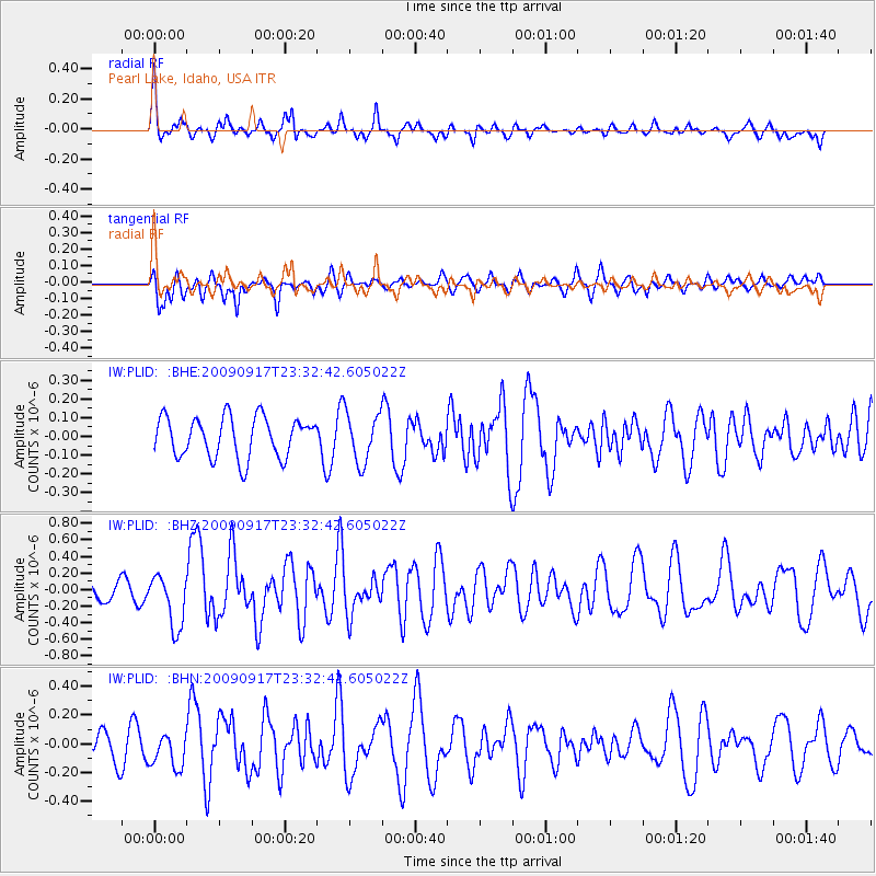
PLID Pearl Lake, Idaho, USA - Earthquake Result Viewer
*The percent match for this event was below the threshold and hence no stack was calculated.
| Earthquake location: |
Easter Island Region |
| Earthquake latitude/longitude: |
-29.1/-112.3 |
| Earthquake time(UTC): |
2009/09/17 (260) 23:21:38 GMT |
| Earthquake Depth: |
10 km |
| Earthquake Magnitude: |
5.7 MB, 6.0 MS, 6.2 MW, 6.2 MW |
| Earthquake Catalog/Contributor: |
WHDF/NEIC |
|
| Network: |
IW Intermountain West |
| Station: |
PLID Pearl Lake, Idaho, USA |
| Lat/Lon: |
45.09 N/116.00 W |
| Elevation: |
2164 m |
|
| Distance: |
74.0 deg |
| Az: |
357.249 deg |
| Baz: |
176.602 deg |
| Ray Param: |
$rayparam |
*The percent match for this event was below the threshold and hence was not used in the summary stack. |
|
| Radial Match: |
74.46818 % |
| Radial Bump: |
400 |
| Transverse Match: |
70.42452 % |
| Transverse Bump: |
400 |
| SOD ConfigId: |
2622 |
| Insert Time: |
2010-03-09 07:27:20.411 +0000 |
| GWidth: |
2.5 |
| Max Bumps: |
400 |
| Tol: |
0.001 |
|
Signal To Noise
| Channel | StoN | STA | LTA |
| IW:PLID: :BHZ:20090917T23:32:42.605022Z | 2.0073078 | 3.203561E-7 | 1.595949E-7 |
| IW:PLID: :BHN:20090917T23:32:42.605022Z | 1.3339164 | 1.1764338E-7 | 8.819397E-8 |
| IW:PLID: :BHE:20090917T23:32:42.605022Z | 1.2372735 | 1.3216147E-7 | 1.0681671E-7 |
| Arrivals |
| Ps | |
| PpPs | |
| PsPs/PpSs | |


