You are here: Home > Network List > IW - Intermountain West Stations List
> Station PLID Pearl Lake, Idaho, USA > Earthquake Result Viewer
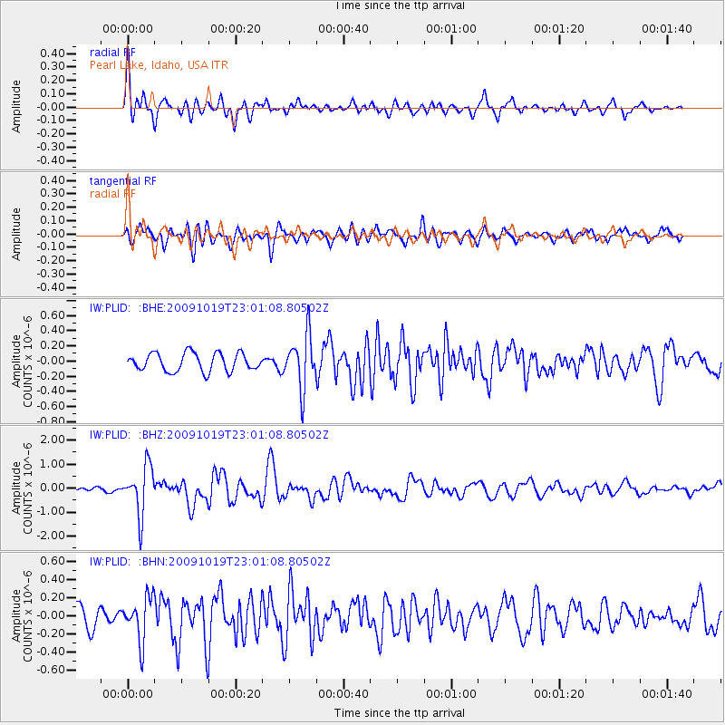
PLID Pearl Lake, Idaho, USA - Earthquake Result Viewer
*The percent match for this event was below the threshold and hence no stack was calculated.
| Earthquake location: |
Samoa Islands Region |
| Earthquake latitude/longitude: |
-15.4/-172.3 |
| Earthquake time(UTC): |
2009/10/19 (292) 22:49:38 GMT |
| Earthquake Depth: |
18 km |
| Earthquake Magnitude: |
6.2 MB, 5.7 MS, 6.0 MW, 5.9 MW |
| Earthquake Catalog/Contributor: |
WHDF/NEIC |
|
| Network: |
IW Intermountain West |
| Station: |
PLID Pearl Lake, Idaho, USA |
| Lat/Lon: |
45.09 N/116.00 W |
| Elevation: |
2164 m |
|
| Distance: |
78.8 deg |
| Az: |
36.905 deg |
| Baz: |
234.862 deg |
| Ray Param: |
$rayparam |
*The percent match for this event was below the threshold and hence was not used in the summary stack. |
|
| Radial Match: |
72.67532 % |
| Radial Bump: |
400 |
| Transverse Match: |
72.7133 % |
| Transverse Bump: |
400 |
| SOD ConfigId: |
2622 |
| Insert Time: |
2010-03-09 07:27:28.717 +0000 |
| GWidth: |
2.5 |
| Max Bumps: |
400 |
| Tol: |
0.001 |
|
Signal To Noise
| Channel | StoN | STA | LTA |
| IW:PLID: :BHZ:20091019T23:01:08.80502Z | 11.631352 | 1.0306829E-6 | 8.861248E-8 |
| IW:PLID: :BHN:20091019T23:01:08.80502Z | 2.23657 | 2.4509882E-7 | 1.0958693E-7 |
| IW:PLID: :BHE:20091019T23:01:08.80502Z | 2.964987 | 3.536346E-7 | 1.192702E-7 |
| Arrivals |
| Ps | |
| PpPs | |
| PsPs/PpSs | |


