You are here: Home > Network List > TA - USArray Transportable Network (new EarthScope stations) Stations List
> Station D23K Nanushuk River, AK USA > Earthquake Result Viewer
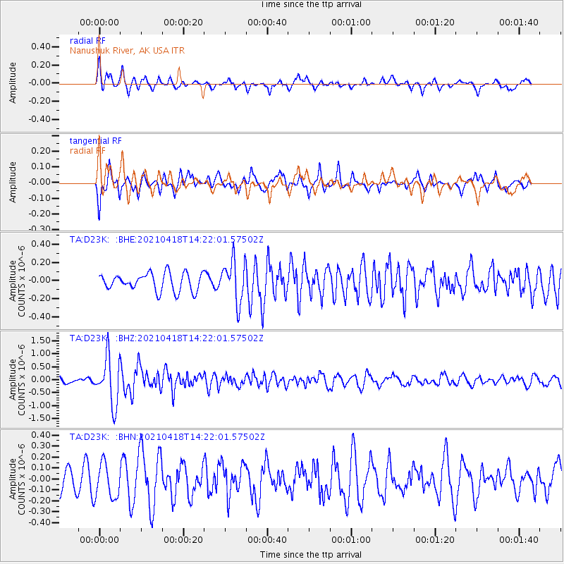
D23K Nanushuk River, AK USA - Earthquake Result Viewer
*The percent match for this event was below the threshold and hence no stack was calculated.
| Earthquake location: |
Taiwan |
| Earthquake latitude/longitude: |
23.8/121.6 |
| Earthquake time(UTC): |
2021/04/18 (108) 14:11:38 GMT |
| Earthquake Depth: |
10 km |
| Earthquake Magnitude: |
5.9 mb |
| Earthquake Catalog/Contributor: |
NEIC PDE/us |
|
| Network: |
TA USArray Transportable Network (new EarthScope stations) |
| Station: |
D23K Nanushuk River, AK USA |
| Lat/Lon: |
68.97 N/150.68 W |
| Elevation: |
406 m |
|
| Distance: |
67.2 deg |
| Az: |
23.033 deg |
| Baz: |
276.938 deg |
| Ray Param: |
$rayparam |
*The percent match for this event was below the threshold and hence was not used in the summary stack. |
|
| Radial Match: |
74.342476 % |
| Radial Bump: |
400 |
| Transverse Match: |
61.159096 % |
| Transverse Bump: |
392 |
| SOD ConfigId: |
24334971 |
| Insert Time: |
2021-05-02 14:28:52.859 +0000 |
| GWidth: |
2.5 |
| Max Bumps: |
400 |
| Tol: |
0.001 |
|
Signal To Noise
| Channel | StoN | STA | LTA |
| TA:D23K: :BHZ:20210418T14:22:01.57502Z | 5.302411 | 9.3512114E-7 | 1.7635773E-7 |
| TA:D23K: :BHN:20210418T14:22:01.57502Z | 1.7387624 | 1.5481682E-7 | 8.903851E-8 |
| TA:D23K: :BHE:20210418T14:22:01.57502Z | 2.4278553 | 2.3603715E-7 | 9.7220436E-8 |
| Arrivals |
| Ps | |
| PpPs | |
| PsPs/PpSs | |


