You are here: Home > Network List > TA - USArray Transportable Network (new EarthScope stations) Stations List
> Station E20K Nigu River, AK, USA > Earthquake Result Viewer
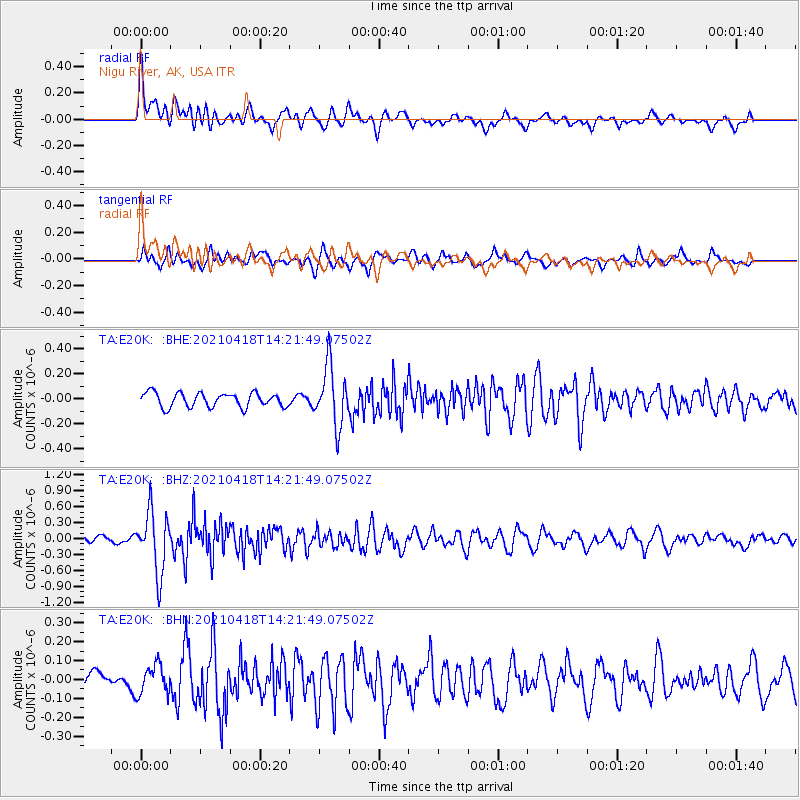
E20K Nigu River, AK, USA - Earthquake Result Viewer
*The percent match for this event was below the threshold and hence no stack was calculated.
| Earthquake location: |
Taiwan |
| Earthquake latitude/longitude: |
23.8/121.6 |
| Earthquake time(UTC): |
2021/04/18 (108) 14:11:38 GMT |
| Earthquake Depth: |
10 km |
| Earthquake Magnitude: |
5.9 mb |
| Earthquake Catalog/Contributor: |
NEIC PDE/us |
|
| Network: |
TA USArray Transportable Network (new EarthScope stations) |
| Station: |
E20K Nigu River, AK, USA |
| Lat/Lon: |
68.26 N/156.19 W |
| Elevation: |
866 m |
|
| Distance: |
65.3 deg |
| Az: |
23.983 deg |
| Baz: |
272.196 deg |
| Ray Param: |
$rayparam |
*The percent match for this event was below the threshold and hence was not used in the summary stack. |
|
| Radial Match: |
71.182335 % |
| Radial Bump: |
400 |
| Transverse Match: |
51.236023 % |
| Transverse Bump: |
400 |
| SOD ConfigId: |
24334971 |
| Insert Time: |
2021-05-02 14:28:58.078 +0000 |
| GWidth: |
2.5 |
| Max Bumps: |
400 |
| Tol: |
0.001 |
|
Signal To Noise
| Channel | StoN | STA | LTA |
| TA:E20K: :BHZ:20210418T14:21:49.07502Z | 6.2228374 | 5.673621E-7 | 9.1174186E-8 |
| TA:E20K: :BHN:20210418T14:21:49.07502Z | 1.0613441 | 7.730168E-8 | 7.283375E-8 |
| TA:E20K: :BHE:20210418T14:21:49.07502Z | 4.1606665 | 2.3584988E-7 | 5.6685607E-8 |
| Arrivals |
| Ps | |
| PpPs | |
| PsPs/PpSs | |


