You are here: Home > Network List > TA - USArray Transportable Network (new EarthScope stations) Stations List
> Station G21K Allakaket, AK, USA > Earthquake Result Viewer
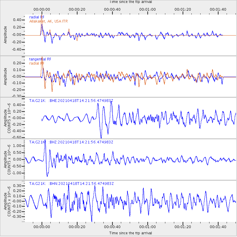
G21K Allakaket, AK, USA - Earthquake Result Viewer
*The percent match for this event was below the threshold and hence no stack was calculated.
| Earthquake location: |
Taiwan |
| Earthquake latitude/longitude: |
23.8/121.6 |
| Earthquake time(UTC): |
2021/04/18 (108) 14:11:38 GMT |
| Earthquake Depth: |
10 km |
| Earthquake Magnitude: |
5.9 mb |
| Earthquake Catalog/Contributor: |
NEIC PDE/us |
|
| Network: |
TA USArray Transportable Network (new EarthScope stations) |
| Station: |
G21K Allakaket, AK, USA |
| Lat/Lon: |
66.52 N/153.51 W |
| Elevation: |
446 m |
|
| Distance: |
66.4 deg |
| Az: |
25.82 deg |
| Baz: |
275.423 deg |
| Ray Param: |
$rayparam |
*The percent match for this event was below the threshold and hence was not used in the summary stack. |
|
| Radial Match: |
76.05881 % |
| Radial Bump: |
400 |
| Transverse Match: |
69.20642 % |
| Transverse Bump: |
400 |
| SOD ConfigId: |
24334971 |
| Insert Time: |
2021-05-02 14:29:22.378 +0000 |
| GWidth: |
2.5 |
| Max Bumps: |
400 |
| Tol: |
0.001 |
|
Signal To Noise
| Channel | StoN | STA | LTA |
| TA:G21K: :BHZ:20210418T14:21:56.474983Z | 5.666629 | 7.1716414E-7 | 1.2655921E-7 |
| TA:G21K: :BHN:20210418T14:21:56.474983Z | 1.152386 | 1.08923196E-7 | 9.451971E-8 |
| TA:G21K: :BHE:20210418T14:21:56.474983Z | 4.684231 | 2.9189817E-7 | 6.231507E-8 |
| Arrivals |
| Ps | |
| PpPs | |
| PsPs/PpSs | |


