You are here: Home > Network List > TA - USArray Transportable Network (new EarthScope stations) Stations List
> Station I30M Mount Dempster, Yukon, CAN > Earthquake Result Viewer
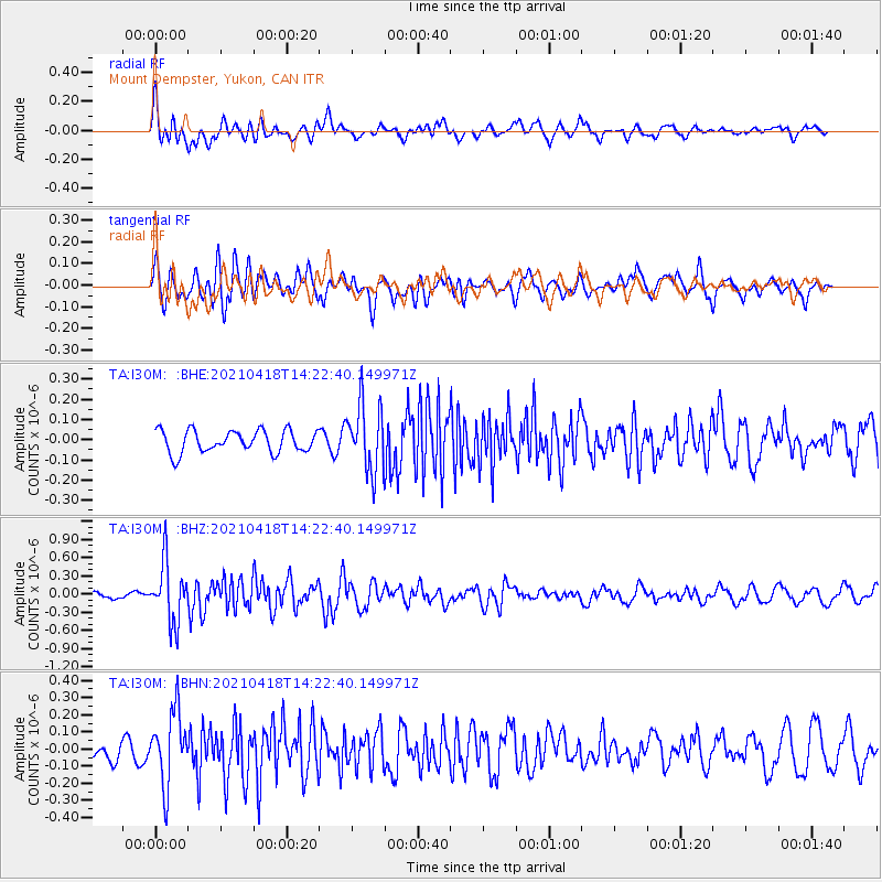
I30M Mount Dempster, Yukon, CAN - Earthquake Result Viewer
*The percent match for this event was below the threshold and hence no stack was calculated.
| Earthquake location: |
Taiwan |
| Earthquake latitude/longitude: |
23.8/121.6 |
| Earthquake time(UTC): |
2021/04/18 (108) 14:11:38 GMT |
| Earthquake Depth: |
10 km |
| Earthquake Magnitude: |
5.9 mb |
| Earthquake Catalog/Contributor: |
NEIC PDE/us |
|
| Network: |
TA USArray Transportable Network (new EarthScope stations) |
| Station: |
I30M Mount Dempster, Yukon, CAN |
| Lat/Lon: |
65.22 N/136.38 W |
| Elevation: |
1399 m |
|
| Distance: |
73.5 deg |
| Az: |
25.449 deg |
| Baz: |
290.931 deg |
| Ray Param: |
$rayparam |
*The percent match for this event was below the threshold and hence was not used in the summary stack. |
|
| Radial Match: |
63.459705 % |
| Radial Bump: |
400 |
| Transverse Match: |
53.852814 % |
| Transverse Bump: |
400 |
| SOD ConfigId: |
24334971 |
| Insert Time: |
2021-05-02 14:29:43.842 +0000 |
| GWidth: |
2.5 |
| Max Bumps: |
400 |
| Tol: |
0.001 |
|
Signal To Noise
| Channel | StoN | STA | LTA |
| TA:I30M: :BHZ:20210418T14:22:40.149971Z | 8.762049 | 4.95167E-7 | 5.6512697E-8 |
| TA:I30M: :BHN:20210418T14:22:40.149971Z | 2.5332515 | 2.107516E-7 | 8.31941E-8 |
| TA:I30M: :BHE:20210418T14:22:40.149971Z | 3.0458813 | 1.6600029E-7 | 5.449992E-8 |
| Arrivals |
| Ps | |
| PpPs | |
| PsPs/PpSs | |


