You are here: Home > Network List > TX - Texas Seismological Network Stations List
> Station SNAG San Augustine > Earthquake Result Viewer
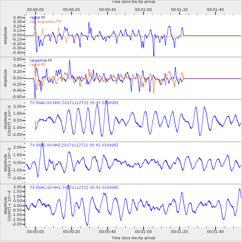
SNAG San Augustine - Earthquake Result Viewer
*The percent match for this event was below the threshold and hence no stack was calculated.
| Earthquake location: |
Off East Coast Of Honshu, Japan |
| Earthquake latitude/longitude: |
38.1/144.9 |
| Earthquake time(UTC): |
2017/11/12 (316) 22:24:07 GMT |
| Earthquake Depth: |
9.5 km |
| Earthquake Magnitude: |
5.8 Mww |
| Earthquake Catalog/Contributor: |
NEIC PDE/us |
|
| Network: |
TX Texas Seismological Network |
| Station: |
SNAG San Augustine |
| Lat/Lon: |
31.52 N/94.18 W |
| Elevation: |
84 m |
|
| Distance: |
91.6 deg |
| Az: |
47.125 deg |
| Baz: |
317.359 deg |
| Ray Param: |
$rayparam |
*The percent match for this event was below the threshold and hence was not used in the summary stack. |
|
| Radial Match: |
54.4933 % |
| Radial Bump: |
400 |
| Transverse Match: |
63.489998 % |
| Transverse Bump: |
382 |
| SOD ConfigId: |
2429771 |
| Insert Time: |
2017-11-26 22:29:30.331 +0000 |
| GWidth: |
2.5 |
| Max Bumps: |
400 |
| Tol: |
0.001 |
|
Signal To Noise
| Channel | StoN | STA | LTA |
| TX:SNAG:00:HHZ:20171112T22:36:43.039998Z | 2.6924999 | 1.4031897E-6 | 5.2114757E-7 |
| TX:SNAG:00:HH1:20171112T22:36:43.039998Z | 0.7458424 | 4.0672603E-7 | 5.453244E-7 |
| TX:SNAG:00:HH2:20171112T22:36:43.039998Z | 1.7150985 | 1.4898036E-6 | 8.6864026E-7 |
| Arrivals |
| Ps | |
| PpPs | |
| PsPs/PpSs | |


