You are here: Home > Network List > US - United States National Seismic Network Stations List
> Station ELK Elko, Nevada, USA > Earthquake Result Viewer
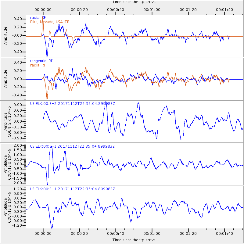
ELK Elko, Nevada, USA - Earthquake Result Viewer
*The percent match for this event was below the threshold and hence no stack was calculated.
| Earthquake location: |
Off East Coast Of Honshu, Japan |
| Earthquake latitude/longitude: |
38.1/144.9 |
| Earthquake time(UTC): |
2017/11/12 (316) 22:24:07 GMT |
| Earthquake Depth: |
9.5 km |
| Earthquake Magnitude: |
5.8 Mww |
| Earthquake Catalog/Contributor: |
NEIC PDE/us |
|
| Network: |
US United States National Seismic Network |
| Station: |
ELK Elko, Nevada, USA |
| Lat/Lon: |
40.74 N/115.24 W |
| Elevation: |
2210 m |
|
| Distance: |
72.8 deg |
| Az: |
51.603 deg |
| Baz: |
305.483 deg |
| Ray Param: |
$rayparam |
*The percent match for this event was below the threshold and hence was not used in the summary stack. |
|
| Radial Match: |
61.936493 % |
| Radial Bump: |
400 |
| Transverse Match: |
74.43645 % |
| Transverse Bump: |
400 |
| SOD ConfigId: |
2429771 |
| Insert Time: |
2017-11-26 22:29:53.209 +0000 |
| GWidth: |
2.5 |
| Max Bumps: |
400 |
| Tol: |
0.001 |
|
Signal To Noise
| Channel | StoN | STA | LTA |
| US:ELK:00:BHZ:20171112T22:35:04.899983Z | 4.835123 | 1.1376858E-6 | 2.3529614E-7 |
| US:ELK:00:BH1:20171112T22:35:04.899983Z | 2.9658854 | 5.363792E-7 | 1.808496E-7 |
| US:ELK:00:BH2:20171112T22:35:04.899983Z | 2.0344567 | 5.217953E-7 | 2.5647893E-7 |
| Arrivals |
| Ps | |
| PpPs | |
| PsPs/PpSs | |


