You are here: Home > Network List > TA - USArray Transportable Network (new EarthScope stations) Stations List
> Station G31M Satah River, YT, CAN > Earthquake Result Viewer
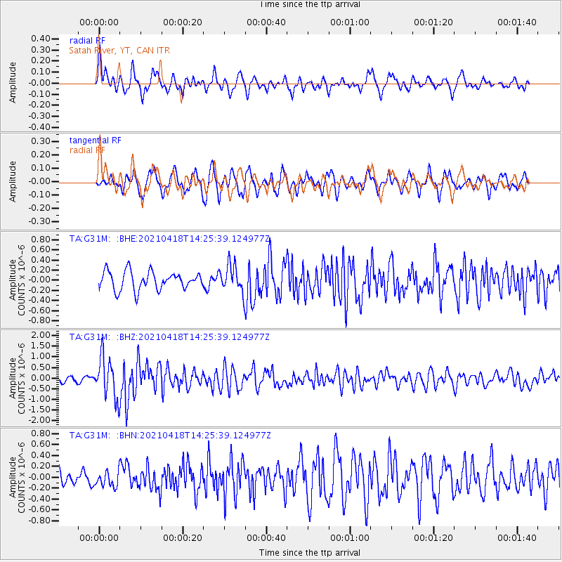
G31M Satah River, YT, CAN - Earthquake Result Viewer
*The percent match for this event was below the threshold and hence no stack was calculated.
| Earthquake location: |
Taiwan |
| Earthquake latitude/longitude: |
23.9/121.5 |
| Earthquake time(UTC): |
2021/04/18 (108) 14:14:36 GMT |
| Earthquake Depth: |
10 km |
| Earthquake Magnitude: |
5.8 mww |
| Earthquake Catalog/Contributor: |
NEIC PDE/us |
|
| Network: |
TA USArray Transportable Network (new EarthScope stations) |
| Station: |
G31M Satah River, YT, CAN |
| Lat/Lon: |
66.92 N/134.27 W |
| Elevation: |
61 m |
|
| Distance: |
73.7 deg |
| Az: |
23.469 deg |
| Baz: |
292.351 deg |
| Ray Param: |
$rayparam |
*The percent match for this event was below the threshold and hence was not used in the summary stack. |
|
| Radial Match: |
64.47398 % |
| Radial Bump: |
400 |
| Transverse Match: |
61.970097 % |
| Transverse Bump: |
400 |
| SOD ConfigId: |
24334971 |
| Insert Time: |
2021-05-02 14:51:43.957 +0000 |
| GWidth: |
2.5 |
| Max Bumps: |
400 |
| Tol: |
0.001 |
|
Signal To Noise
| Channel | StoN | STA | LTA |
| TA:G31M: :BHZ:20210418T14:25:39.124977Z | 6.231266 | 9.950531E-7 | 1.5968715E-7 |
| TA:G31M: :BHN:20210418T14:25:39.124977Z | 0.99740374 | 1.4124218E-7 | 1.4160985E-7 |
| TA:G31M: :BHE:20210418T14:25:39.124977Z | 1.5307823 | 2.7435658E-7 | 1.7922639E-7 |
| Arrivals |
| Ps | |
| PpPs | |
| PsPs/PpSs | |


