You are here: Home > Network List > TA - USArray Transportable Network (new EarthScope stations) Stations List
> Station E20K Nigu River, AK, USA > Earthquake Result Viewer
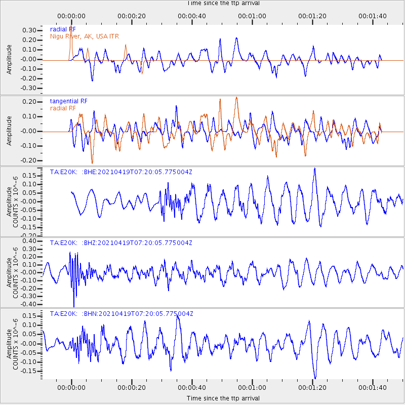
E20K Nigu River, AK, USA - Earthquake Result Viewer
*The percent match for this event was below the threshold and hence no stack was calculated.
| Earthquake location: |
Banda Sea |
| Earthquake latitude/longitude: |
-7.8/127.7 |
| Earthquake time(UTC): |
2021/04/19 (109) 07:07:37 GMT |
| Earthquake Depth: |
85 km |
| Earthquake Magnitude: |
5.1 Mww |
| Earthquake Catalog/Contributor: |
NEIC PDE/us |
|
| Network: |
TA USArray Transportable Network (new EarthScope stations) |
| Station: |
E20K Nigu River, AK, USA |
| Lat/Lon: |
68.26 N/156.19 W |
| Elevation: |
866 m |
|
| Distance: |
92.1 deg |
| Az: |
21.217 deg |
| Baz: |
254.249 deg |
| Ray Param: |
$rayparam |
*The percent match for this event was below the threshold and hence was not used in the summary stack. |
|
| Radial Match: |
33.451668 % |
| Radial Bump: |
400 |
| Transverse Match: |
46.773777 % |
| Transverse Bump: |
400 |
| SOD ConfigId: |
24334971 |
| Insert Time: |
2021-05-03 07:16:38.169 +0000 |
| GWidth: |
2.5 |
| Max Bumps: |
400 |
| Tol: |
0.001 |
|
Signal To Noise
| Channel | StoN | STA | LTA |
| TA:E20K: :BHZ:20210419T07:20:05.775004Z | 2.000999 | 1.5402242E-7 | 7.697276E-8 |
| TA:E20K: :BHN:20210419T07:20:05.775004Z | 1.1751815 | 4.282365E-8 | 3.6440028E-8 |
| TA:E20K: :BHE:20210419T07:20:05.775004Z | 1.2662889 | 5.0754323E-8 | 4.0081154E-8 |
| Arrivals |
| Ps | |
| PpPs | |
| PsPs/PpSs | |


