You are here: Home > Network List > TA - USArray Transportable Network (new EarthScope stations) Stations List
> Station F26K Sheenjek River, AK, USA > Earthquake Result Viewer
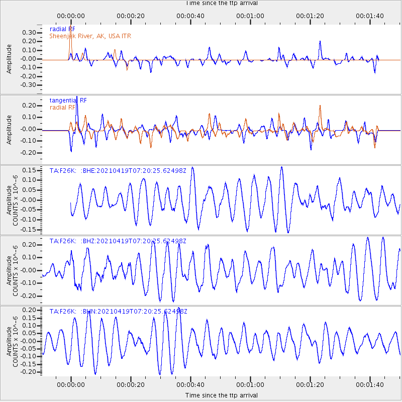
F26K Sheenjek River, AK, USA - Earthquake Result Viewer
*The percent match for this event was below the threshold and hence no stack was calculated.
| Earthquake location: |
Banda Sea |
| Earthquake latitude/longitude: |
-7.8/127.7 |
| Earthquake time(UTC): |
2021/04/19 (109) 07:07:37 GMT |
| Earthquake Depth: |
85 km |
| Earthquake Magnitude: |
5.1 Mww |
| Earthquake Catalog/Contributor: |
NEIC PDE/us |
|
| Network: |
TA USArray Transportable Network (new EarthScope stations) |
| Station: |
F26K Sheenjek River, AK, USA |
| Lat/Lon: |
67.69 N/144.15 W |
| Elevation: |
683 m |
|
| Distance: |
96.4 deg |
| Az: |
22.579 deg |
| Baz: |
265.307 deg |
| Ray Param: |
$rayparam |
*The percent match for this event was below the threshold and hence was not used in the summary stack. |
|
| Radial Match: |
27.733932 % |
| Radial Bump: |
286 |
| Transverse Match: |
44.085068 % |
| Transverse Bump: |
329 |
| SOD ConfigId: |
24334971 |
| Insert Time: |
2021-05-03 07:16:42.006 +0000 |
| GWidth: |
2.5 |
| Max Bumps: |
400 |
| Tol: |
0.001 |
|
Signal To Noise
| Channel | StoN | STA | LTA |
| TA:F26K: :BHZ:20210419T07:20:25.62498Z | 1.2580148 | 9.8701875E-8 | 7.845844E-8 |
| TA:F26K: :BHN:20210419T07:20:25.62498Z | 2.5854168 | 1.129091E-7 | 4.367153E-8 |
| TA:F26K: :BHE:20210419T07:20:25.62498Z | 0.77468467 | 4.2885326E-8 | 5.535843E-8 |
| Arrivals |
| Ps | |
| PpPs | |
| PsPs/PpSs | |


