You are here: Home > Network List > TA - USArray Transportable Network (new EarthScope stations) Stations List
> Station L15K Ungalak Mountain, AK, USA > Earthquake Result Viewer
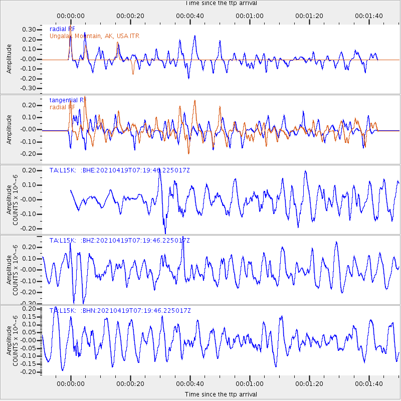
L15K Ungalak Mountain, AK, USA - Earthquake Result Viewer
*The percent match for this event was below the threshold and hence no stack was calculated.
| Earthquake location: |
Banda Sea |
| Earthquake latitude/longitude: |
-7.8/127.7 |
| Earthquake time(UTC): |
2021/04/19 (109) 07:07:37 GMT |
| Earthquake Depth: |
85 km |
| Earthquake Magnitude: |
5.1 Mww |
| Earthquake Catalog/Contributor: |
NEIC PDE/us |
|
| Network: |
TA USArray Transportable Network (new EarthScope stations) |
| Station: |
L15K Ungalak Mountain, AK, USA |
| Lat/Lon: |
61.68 N/161.49 W |
| Elevation: |
219 m |
|
| Distance: |
87.9 deg |
| Az: |
26.786 deg |
| Baz: |
249.447 deg |
| Ray Param: |
$rayparam |
*The percent match for this event was below the threshold and hence was not used in the summary stack. |
|
| Radial Match: |
58.93718 % |
| Radial Bump: |
369 |
| Transverse Match: |
46.704887 % |
| Transverse Bump: |
400 |
| SOD ConfigId: |
24334971 |
| Insert Time: |
2021-05-03 07:16:52.693 +0000 |
| GWidth: |
2.5 |
| Max Bumps: |
400 |
| Tol: |
0.001 |
|
Signal To Noise
| Channel | StoN | STA | LTA |
| TA:L15K: :BHZ:20210419T07:19:46.225017Z | 2.2025282 | 1.7011477E-7 | 7.723614E-8 |
| TA:L15K: :BHN:20210419T07:19:46.225017Z | 0.8379848 | 7.50449E-8 | 8.9554014E-8 |
| TA:L15K: :BHE:20210419T07:19:46.225017Z | 3.582974 | 1.1895162E-7 | 3.319913E-8 |
| Arrivals |
| Ps | |
| PpPs | |
| PsPs/PpSs | |


