You are here: Home > Network List > TA - USArray Transportable Network (new EarthScope stations) Stations List
> Station G16K Koyuk River, AK, USA > Earthquake Result Viewer
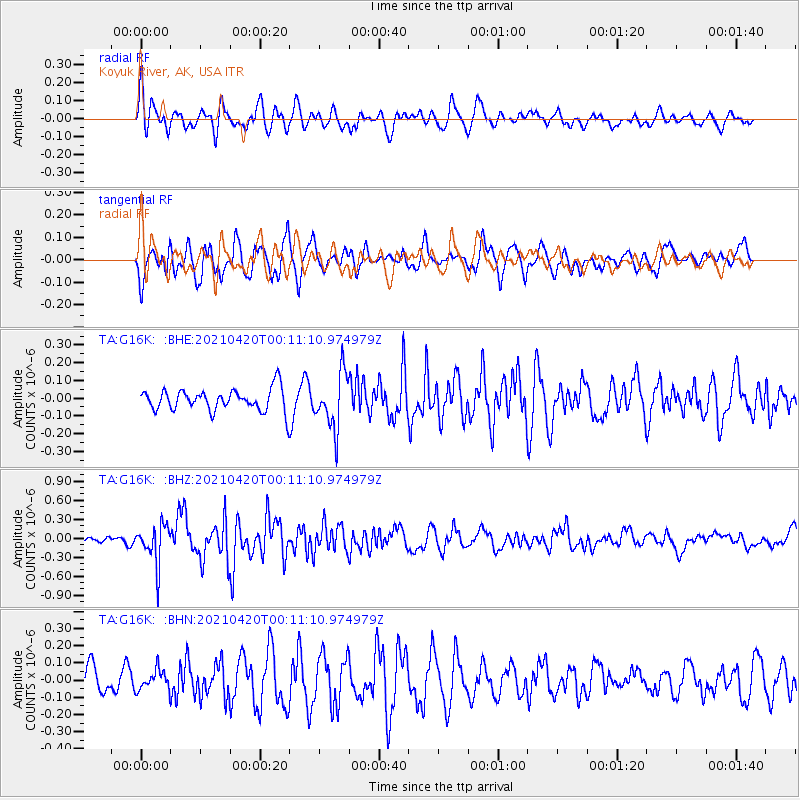
G16K Koyuk River, AK, USA - Earthquake Result Viewer
*The percent match for this event was below the threshold and hence no stack was calculated.
| Earthquake location: |
Off W Coast Of Northern Sumatra |
| Earthquake latitude/longitude: |
0.2/96.5 |
| Earthquake time(UTC): |
2021/04/19 (109) 23:58:22 GMT |
| Earthquake Depth: |
10 km |
| Earthquake Magnitude: |
6.0 mww |
| Earthquake Catalog/Contributor: |
NEIC PDE/us |
|
| Network: |
TA USArray Transportable Network (new EarthScope stations) |
| Station: |
G16K Koyuk River, AK, USA |
| Lat/Lon: |
65.39 N/162.35 W |
| Elevation: |
169 m |
|
| Distance: |
94.5 deg |
| Az: |
24.337 deg |
| Baz: |
280.18 deg |
| Ray Param: |
$rayparam |
*The percent match for this event was below the threshold and hence was not used in the summary stack. |
|
| Radial Match: |
52.886974 % |
| Radial Bump: |
400 |
| Transverse Match: |
65.036575 % |
| Transverse Bump: |
400 |
| SOD ConfigId: |
24334971 |
| Insert Time: |
2021-05-04 00:08:39.694 +0000 |
| GWidth: |
2.5 |
| Max Bumps: |
400 |
| Tol: |
0.001 |
|
Signal To Noise
| Channel | StoN | STA | LTA |
| TA:G16K: :BHZ:20210420T00:11:10.974979Z | 4.931151 | 3.1158456E-7 | 6.318699E-8 |
| TA:G16K: :BHN:20210420T00:11:10.974979Z | 0.69495064 | 5.7147357E-8 | 8.2232255E-8 |
| TA:G16K: :BHE:20210420T00:11:10.974979Z | 2.5500288 | 1.5695746E-7 | 6.155125E-8 |
| Arrivals |
| Ps | |
| PpPs | |
| PsPs/PpSs | |


