You are here: Home > Network List > TA - USArray Transportable Network (new EarthScope stations) Stations List
> Station G21K Allakaket, AK, USA > Earthquake Result Viewer
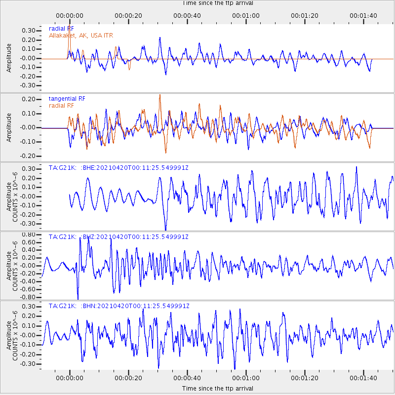
G21K Allakaket, AK, USA - Earthquake Result Viewer
*The percent match for this event was below the threshold and hence no stack was calculated.
| Earthquake location: |
Off W Coast Of Northern Sumatra |
| Earthquake latitude/longitude: |
0.2/96.5 |
| Earthquake time(UTC): |
2021/04/19 (109) 23:58:22 GMT |
| Earthquake Depth: |
10 km |
| Earthquake Magnitude: |
6.0 mww |
| Earthquake Catalog/Contributor: |
NEIC PDE/us |
|
| Network: |
TA USArray Transportable Network (new EarthScope stations) |
| Station: |
G21K Allakaket, AK, USA |
| Lat/Lon: |
66.52 N/153.51 W |
| Elevation: |
446 m |
|
| Distance: |
97.7 deg |
| Az: |
22.341 deg |
| Baz: |
288.467 deg |
| Ray Param: |
$rayparam |
*The percent match for this event was below the threshold and hence was not used in the summary stack. |
|
| Radial Match: |
57.003716 % |
| Radial Bump: |
400 |
| Transverse Match: |
63.170444 % |
| Transverse Bump: |
400 |
| SOD ConfigId: |
24334971 |
| Insert Time: |
2021-05-04 00:08:41.460 +0000 |
| GWidth: |
2.5 |
| Max Bumps: |
400 |
| Tol: |
0.001 |
|
Signal To Noise
| Channel | StoN | STA | LTA |
| TA:G21K: :BHZ:20210420T00:11:25.549991Z | 2.63666 | 2.9107116E-7 | 1.1039389E-7 |
| TA:G21K: :BHN:20210420T00:11:25.549991Z | 1.1051835 | 1.07630825E-7 | 9.738729E-8 |
| TA:G21K: :BHE:20210420T00:11:25.549991Z | 2.181047 | 1.7369833E-7 | 7.963988E-8 |
| Arrivals |
| Ps | |
| PpPs | |
| PsPs/PpSs | |


