You are here: Home > Network List > TA - USArray Transportable Network (new EarthScope stations) Stations List
> Station D23K Nanushuk River, AK USA > Earthquake Result Viewer
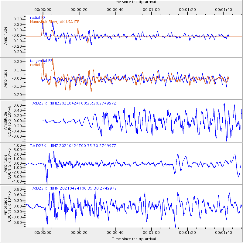
D23K Nanushuk River, AK USA - Earthquake Result Viewer
*The percent match for this event was below the threshold and hence no stack was calculated.
| Earthquake location: |
Fiji Islands Region |
| Earthquake latitude/longitude: |
-18.9/-176.2 |
| Earthquake time(UTC): |
2021/04/24 (114) 00:23:36 GMT |
| Earthquake Depth: |
289 km |
| Earthquake Magnitude: |
6.4 Mww |
| Earthquake Catalog/Contributor: |
NEIC PDE/us |
|
| Network: |
TA USArray Transportable Network (new EarthScope stations) |
| Station: |
D23K Nanushuk River, AK USA |
| Lat/Lon: |
68.97 N/150.68 W |
| Elevation: |
406 m |
|
| Distance: |
89.6 deg |
| Az: |
8.96 deg |
| Baz: |
204.102 deg |
| Ray Param: |
$rayparam |
*The percent match for this event was below the threshold and hence was not used in the summary stack. |
|
| Radial Match: |
79.07643 % |
| Radial Bump: |
394 |
| Transverse Match: |
61.502327 % |
| Transverse Bump: |
400 |
| SOD ConfigId: |
24334971 |
| Insert Time: |
2021-05-08 00:49:58.493 +0000 |
| GWidth: |
2.5 |
| Max Bumps: |
400 |
| Tol: |
0.001 |
|
Signal To Noise
| Channel | StoN | STA | LTA |
| TA:D23K: :BHZ:20210424T00:35:30.274997Z | 14.070181 | 1.5028792E-6 | 1.0681306E-7 |
| TA:D23K: :BHN:20210424T00:35:30.274997Z | 3.50497 | 3.6843542E-7 | 1.05118E-7 |
| TA:D23K: :BHE:20210424T00:35:30.274997Z | 4.2073474 | 2.7878338E-7 | 6.626107E-8 |
| Arrivals |
| Ps | |
| PpPs | |
| PsPs/PpSs | |


