You are here: Home > Network List > TA - USArray Transportable Network (new EarthScope stations) Stations List
> Station H31M Peel River, Yukon, CAN > Earthquake Result Viewer
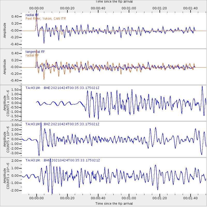
H31M Peel River, Yukon, CAN - Earthquake Result Viewer
*The percent match for this event was below the threshold and hence no stack was calculated.
| Earthquake location: |
Fiji Islands Region |
| Earthquake latitude/longitude: |
-18.9/-176.2 |
| Earthquake time(UTC): |
2021/04/24 (114) 00:23:36 GMT |
| Earthquake Depth: |
289 km |
| Earthquake Magnitude: |
6.4 Mww |
| Earthquake Catalog/Contributor: |
NEIC PDE/us |
|
| Network: |
TA USArray Transportable Network (new EarthScope stations) |
| Station: |
H31M Peel River, Yukon, CAN |
| Lat/Lon: |
65.81 N/134.34 W |
| Elevation: |
642 m |
|
| Distance: |
90.2 deg |
| Az: |
15.974 deg |
| Baz: |
219.206 deg |
| Ray Param: |
$rayparam |
*The percent match for this event was below the threshold and hence was not used in the summary stack. |
|
| Radial Match: |
77.48303 % |
| Radial Bump: |
400 |
| Transverse Match: |
57.451794 % |
| Transverse Bump: |
400 |
| SOD ConfigId: |
24334971 |
| Insert Time: |
2021-05-08 00:50:41.280 +0000 |
| GWidth: |
2.5 |
| Max Bumps: |
400 |
| Tol: |
0.001 |
|
Signal To Noise
| Channel | StoN | STA | LTA |
| TA:H31M: :BHZ:20210424T00:35:33.175021Z | 8.916371 | 1.7469579E-6 | 1.9592702E-7 |
| TA:H31M: :BHN:20210424T00:35:33.175021Z | 3.5433605 | 5.5687724E-7 | 1.5716077E-7 |
| TA:H31M: :BHE:20210424T00:35:33.175021Z | 5.279227 | 7.4032533E-7 | 1.4023367E-7 |
| Arrivals |
| Ps | |
| PpPs | |
| PsPs/PpSs | |


