You are here: Home > Network List > TA - USArray Transportable Network (new EarthScope stations) Stations List
> Station R33M Jennings River, BC, CAN > Earthquake Result Viewer
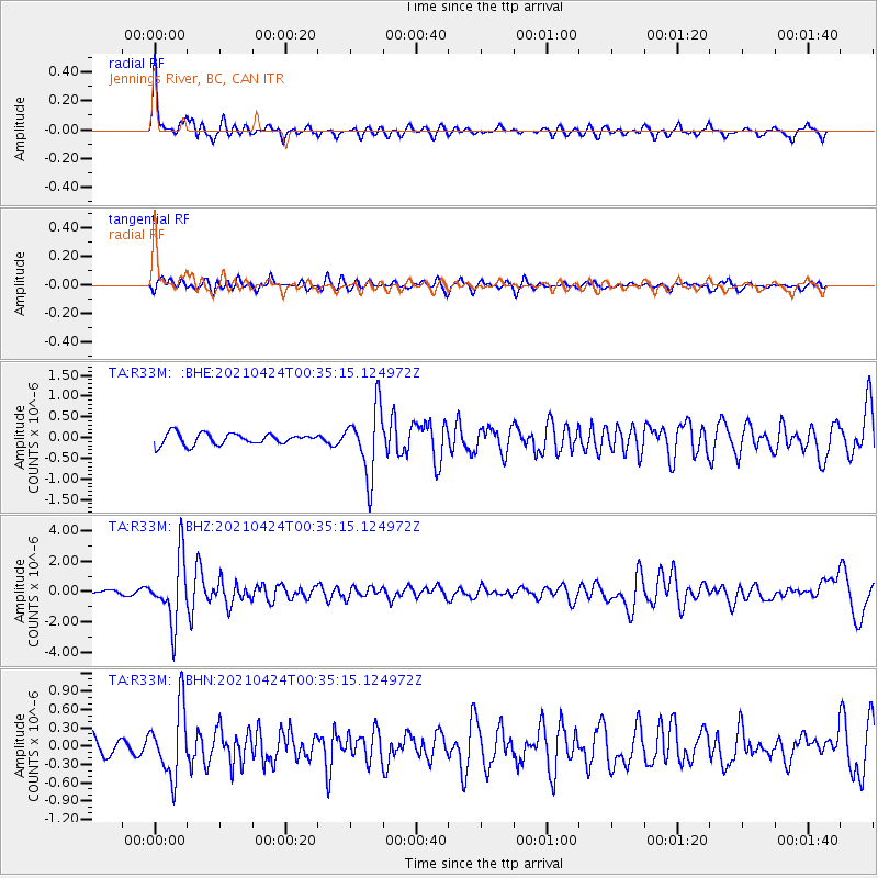
R33M Jennings River, BC, CAN - Earthquake Result Viewer
*The percent match for this event was below the threshold and hence no stack was calculated.
| Earthquake location: |
Fiji Islands Region |
| Earthquake latitude/longitude: |
-18.9/-176.2 |
| Earthquake time(UTC): |
2021/04/24 (114) 00:23:36 GMT |
| Earthquake Depth: |
289 km |
| Earthquake Magnitude: |
6.4 Mww |
| Earthquake Catalog/Contributor: |
NEIC PDE/us |
|
| Network: |
TA USArray Transportable Network (new EarthScope stations) |
| Station: |
R33M Jennings River, BC, CAN |
| Lat/Lon: |
59.39 N/130.97 W |
| Elevation: |
1437 m |
|
| Distance: |
86.3 deg |
| Az: |
21.36 deg |
| Baz: |
222.367 deg |
| Ray Param: |
$rayparam |
*The percent match for this event was below the threshold and hence was not used in the summary stack. |
|
| Radial Match: |
79.591576 % |
| Radial Bump: |
353 |
| Transverse Match: |
52.775852 % |
| Transverse Bump: |
389 |
| SOD ConfigId: |
24334971 |
| Insert Time: |
2021-05-08 00:51:35.094 +0000 |
| GWidth: |
2.5 |
| Max Bumps: |
400 |
| Tol: |
0.001 |
|
Signal To Noise
| Channel | StoN | STA | LTA |
| TA:R33M: :BHZ:20210424T00:35:15.124972Z | 10.57363 | 2.1017042E-6 | 1.9876846E-7 |
| TA:R33M: :BHN:20210424T00:35:15.124972Z | 4.7408147 | 5.636886E-7 | 1.1890121E-7 |
| TA:R33M: :BHE:20210424T00:35:15.124972Z | 5.9693346 | 8.1234407E-7 | 1.360862E-7 |
| Arrivals |
| Ps | |
| PpPs | |
| PsPs/PpSs | |


