
KDJ XW.KDJ - Earthquake Result Viewer
| ||||||||||||||||||
| ||||||||||||||||||
| ||||||||||||||||||
|
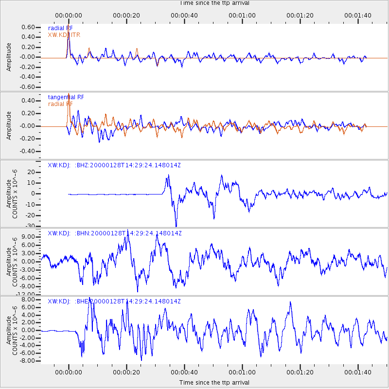
Signal To Noise
| Channel | StoN | STA | LTA |
| XW:KDJ: :BHN:20000128T14:29:24.148014Z | 1.2651839 | 3.249355E-6 | 2.5682864E-6 |
| XW:KDJ: :BHE:20000128T14:29:24.148014Z | 19.880402 | 2.1524797E-6 | 1.08271436E-7 |
| XW:KDJ: :BHZ:20000128T14:29:24.148014Z | 80.59347 | 6.6662747E-6 | 8.271483E-8 |
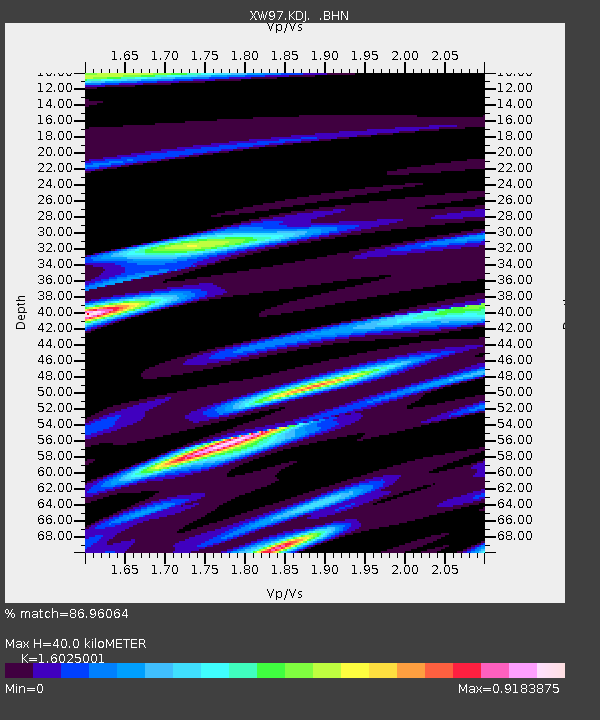
| Arrivals | |
| Ps | 4.1 SECOND |
| PpPs | 16 SECOND |
| PsPs/PpSs | 20 SECOND |

