KDJ XW.KDJ - Earthquake Result Viewer
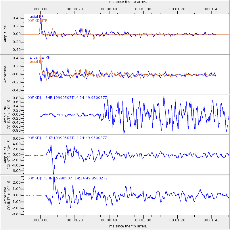
Earthquake location: Kodiak Island Region, Alaska
Earthquake latitude/longitude: 56.4/-152.9
Earthquake time(UTC): 1999/05/07 (127) 14:13:52 GMT
Earthquake Depth: 20 km
Earthquake Magnitude: 5.7 MB, 6.1 MS, 6.4 MW, 5.7 ME
Earthquake Catalog/Contributor: WHDF/NEIC
Network: XW Tien Shan Continental Dynamics
Station: KDJ XW.KDJ
Lat/Lon: 42.13 N/77.19 E
Elevation: 1783 m
Distance: 73.1 deg
Az: 323.373 deg
Baz: 26.47 deg
Ray Param: 0.053204104
Estimated Moho Depth: 61.0 km
Estimated Crust Vp/Vs: 1.84
Assumed Crust Vp: 6.306 km/s
Estimated Crust Vs: 3.437 km/s
Estimated Crust Poisson's Ratio: 0.29
Radial Match: 94.45375 %
Radial Bump: 400
Transverse Match: 91.71901 %
Transverse Bump: 400
SOD ConfigId: 4480
Insert Time: 2010-02-26 15:31:42.198 +0000
GWidth: 2.5
Max Bumps: 400
Tol: 0.001

Signal To Noise

ChannelStoNSTALTA
XW:KDJ: :BHZ:19990507T14:24:49.950027Z9.1827317.0949494E-77.726405E-8
XW:KDJ: :BHN:19990507T14:24:49.950027Z4.67001872.160581E-74.6264933E-8
XW:KDJ: :BHE:19990507T14:24:49.950027Z1.23064985.31856E-84.321749E-8
Arrivals
Ps8.3 SECOND
PpPs27 SECOND
PsPs/PpSs35 SECOND