KDJ XW.KDJ - Earthquake Result Viewer
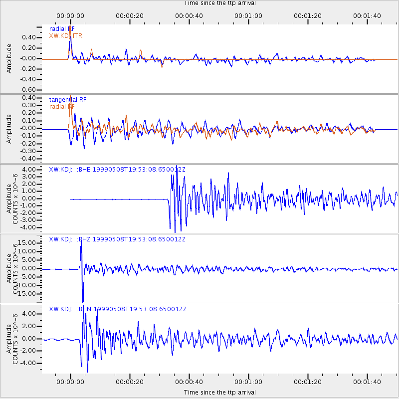
Earthquake location: Kuril Islands
Earthquake latitude/longitude: 45.4/151.6
Earthquake time(UTC): 1999/05/08 (128) 19:44:35 GMT
Earthquake Depth: 63 km
Earthquake Magnitude: 6.2 MB, 5.3 MS, 5.9 MW, 5.9 MW
Earthquake Catalog/Contributor: WHDF/NEIC
Network: XW Tien Shan Continental Dynamics
Station: KDJ XW.KDJ
Lat/Lon: 42.13 N/77.19 E
Elevation: 1783 m
Distance: 52.0 deg
Az: 294.648 deg
Baz: 59.332 deg
Ray Param: 0.066845395
Estimated Moho Depth: 40.5 km
Estimated Crust Vp/Vs: 2.07
Assumed Crust Vp: 6.306 km/s
Estimated Crust Vs: 3.043 km/s
Estimated Crust Poisson's Ratio: 0.35
Radial Match: 90.079346 %
Radial Bump: 400
Transverse Match: 91.0925 %
Transverse Bump: 400
SOD ConfigId: 4480
Insert Time: 2010-02-26 15:31:43.262 +0000
GWidth: 2.5
Max Bumps: 400
Tol: 0.001

Signal To Noise

ChannelStoNSTALTA
XW:KDJ: :BHZ:19990508T19:53:08.650012Z129.656336.416779E-64.9490673E-8
XW:KDJ: :BHN:19990508T19:53:08.650012Z25.78521.6494705E-66.396966E-8
XW:KDJ: :BHE:19990508T19:53:08.650012Z48.2918471.3714117E-62.8398413E-8
Arrivals
Ps7.2 SECOND
PpPs19 SECOND
PsPs/PpSs26 SECOND