You are here: Home > Network List > UW - Pacific Northwest Regional Seismic Network Stations List
> Station FISH Seaside, OR, USA > Earthquake Result Viewer
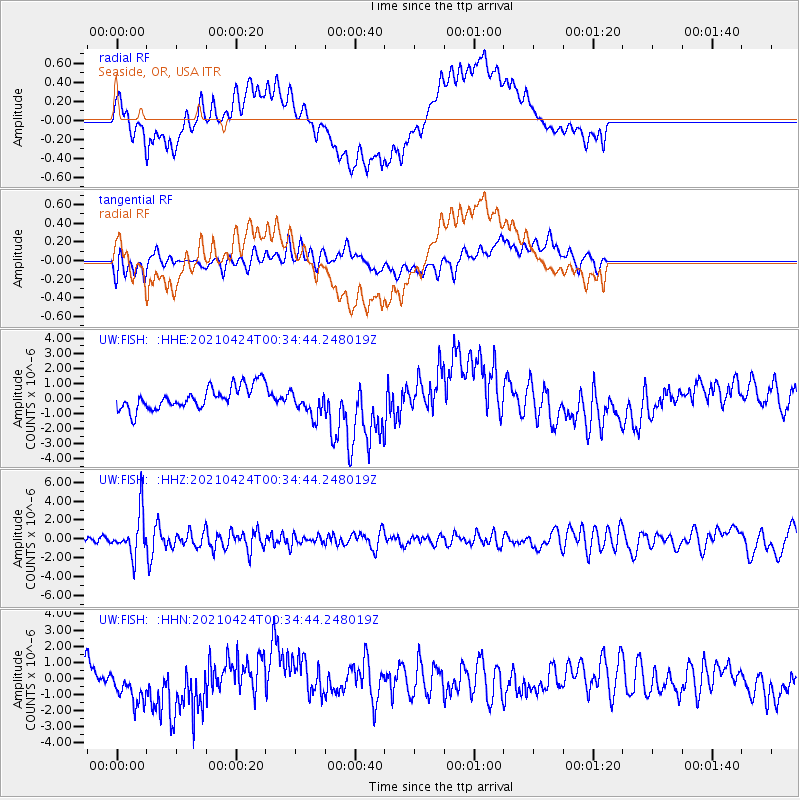
FISH Seaside, OR, USA - Earthquake Result Viewer
*The percent match for this event was below the threshold and hence no stack was calculated.
| Earthquake location: |
Fiji Islands Region |
| Earthquake latitude/longitude: |
-18.9/-176.2 |
| Earthquake time(UTC): |
2021/04/24 (114) 00:23:36 GMT |
| Earthquake Depth: |
289 km |
| Earthquake Magnitude: |
6.4 Mww |
| Earthquake Catalog/Contributor: |
NEIC PDE/us |
|
| Network: |
UW Pacific Northwest Regional Seismic Network |
| Station: |
FISH Seaside, OR, USA |
| Lat/Lon: |
45.93 N/123.56 W |
| Elevation: |
325 m |
|
| Distance: |
80.2 deg |
| Az: |
34.277 deg |
| Baz: |
229.807 deg |
| Ray Param: |
$rayparam |
*The percent match for this event was below the threshold and hence was not used in the summary stack. |
|
| Radial Match: |
57.905895 % |
| Radial Bump: |
400 |
| Transverse Match: |
48.047497 % |
| Transverse Bump: |
400 |
| SOD ConfigId: |
24334971 |
| Insert Time: |
2021-05-08 00:56:33.065 +0000 |
| GWidth: |
2.5 |
| Max Bumps: |
400 |
| Tol: |
0.001 |
|
Signal To Noise
| Channel | StoN | STA | LTA |
| UW:FISH: :HHZ:20210424T00:34:44.248019Z | 8.030073 | 2.2317836E-6 | 2.7792817E-7 |
| UW:FISH: :HHN:20210424T00:34:44.248019Z | 1.662991 | 1.2328753E-6 | 7.4136017E-7 |
| UW:FISH: :HHE:20210424T00:34:44.248019Z | 1.1567187 | 8.753856E-7 | 7.5678344E-7 |
| Arrivals |
| Ps | |
| PpPs | |
| PsPs/PpSs | |


